Planning visualisations & verified views
Selected projects
by preconstruct.com
Preconstruct is a creative studio specialising in communications for the built environment.
20 years’ experience in producing visuals for planning applications, delivering hundreds of projects across the built environment — from residential towers and masterplans to heritage estates, infrastructure, stadiums and data centres.
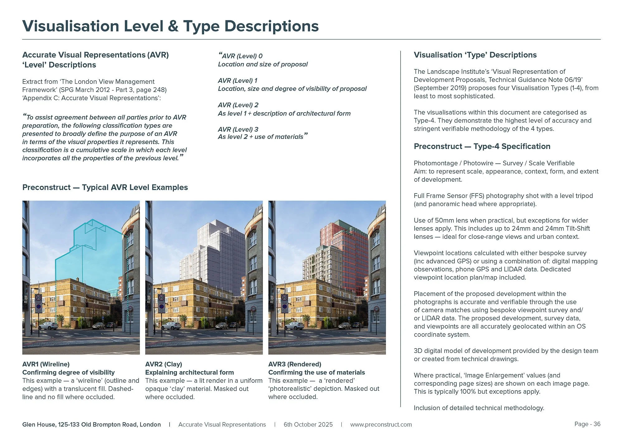
Producers of AVR (Accurate Visual Representations), also known as: Verified Views, Type-4 Visualisations, Visually Verified Images/Montages (VVI / VVM).
Guideline-compliant views suitable for visual impact assessments (LVIA, TVIA, HTVIA…)
Non-verified CGIs & photomontages for Design & Access Statements, marketing and stakeholder communications.
A single, dependable source combining in-house technical expertise with a friendly, collaborative approach.
Planning clients
BDP / City of York Council / HED / Hill Group / Iceni Projects / Lichfields / Montagu Evans / Quod / Savills / Stantec / Turley
Selected projects illustrating the breadth and technical precision of our planning imagery…
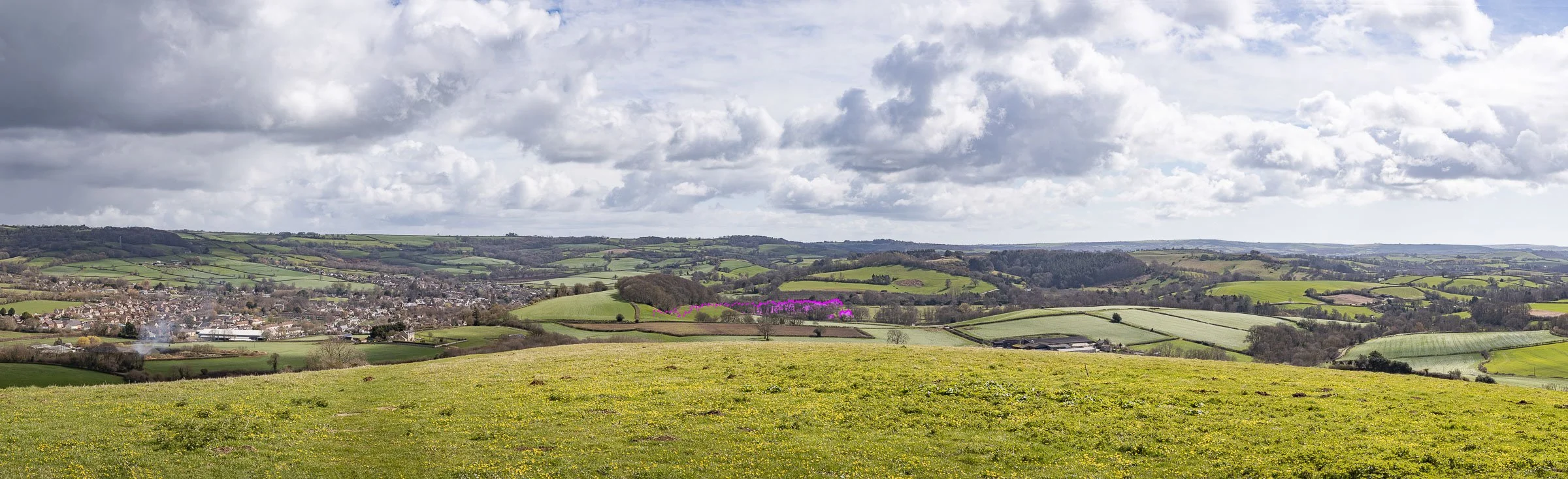
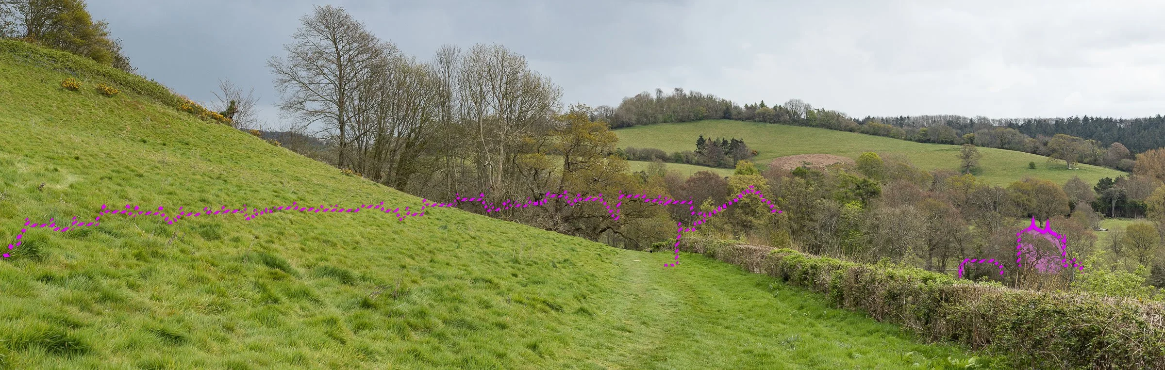
North Warmley Masterplan
AVRs / Verified views: preconstruct.com
Developer: Bloor Homes
Landscape & LVIA: Stantec
Planning Stage: Outline Planning Application
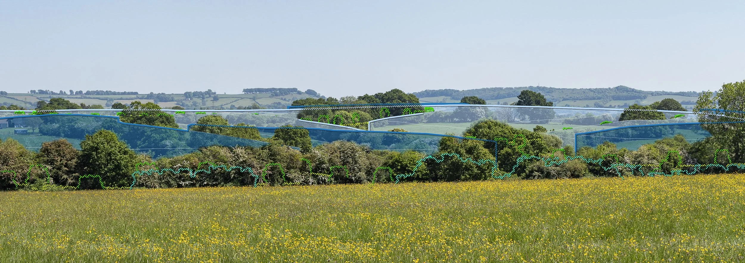
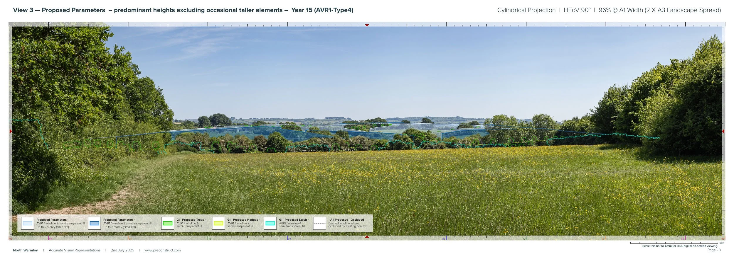
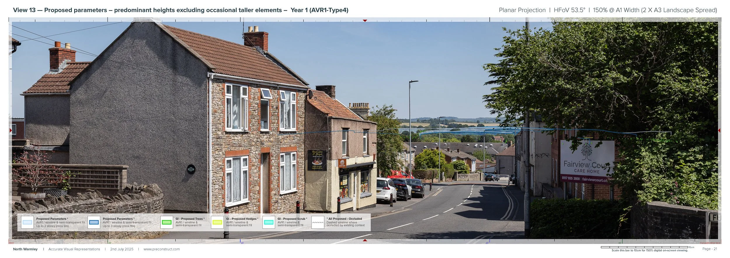
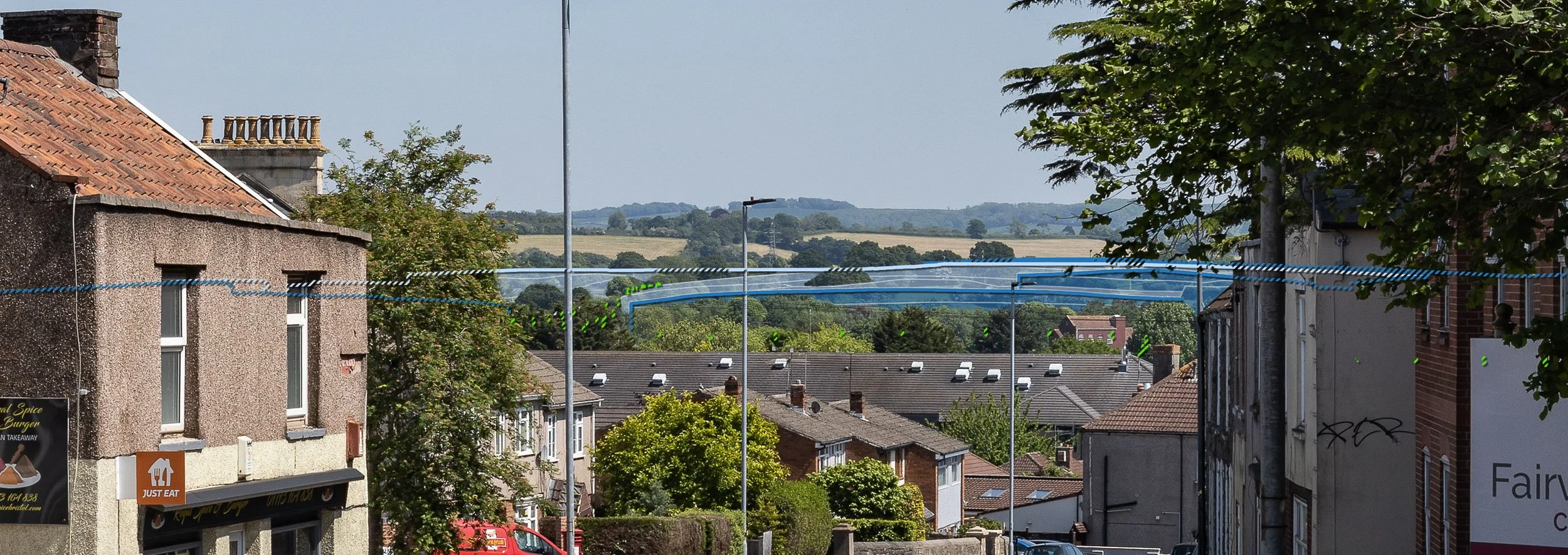
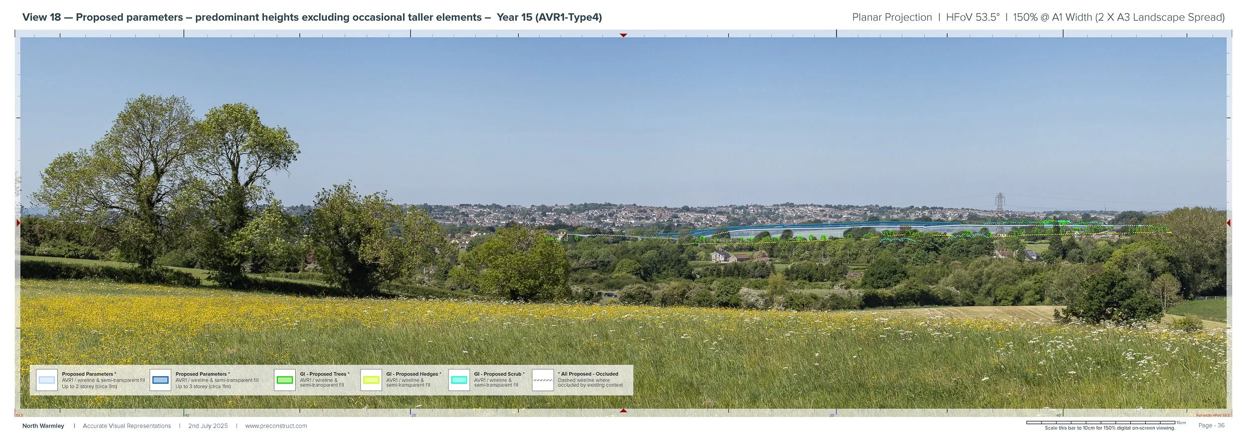
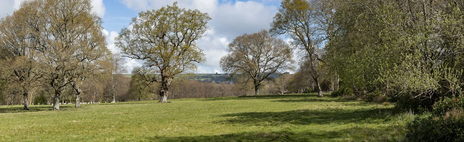
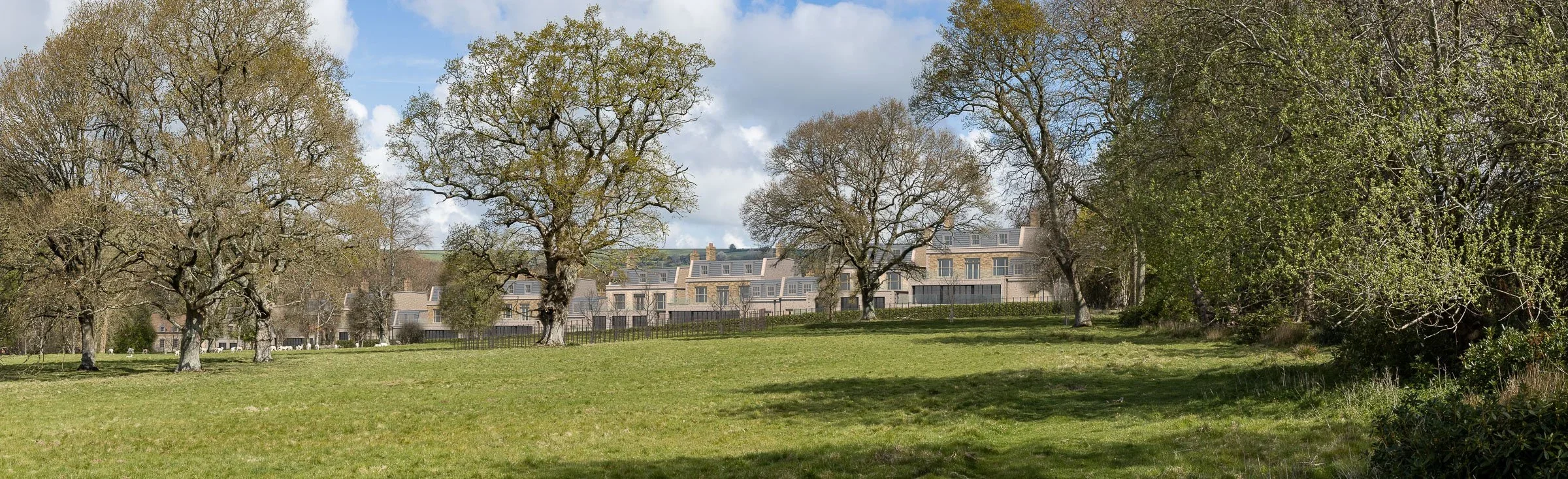
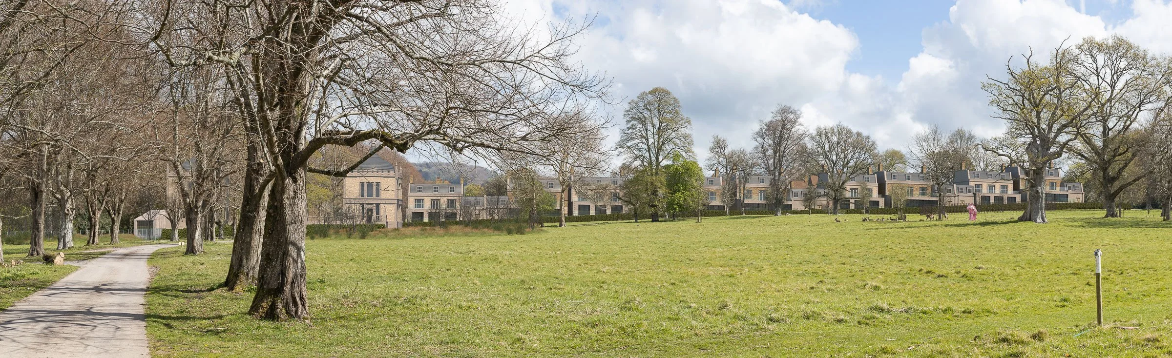
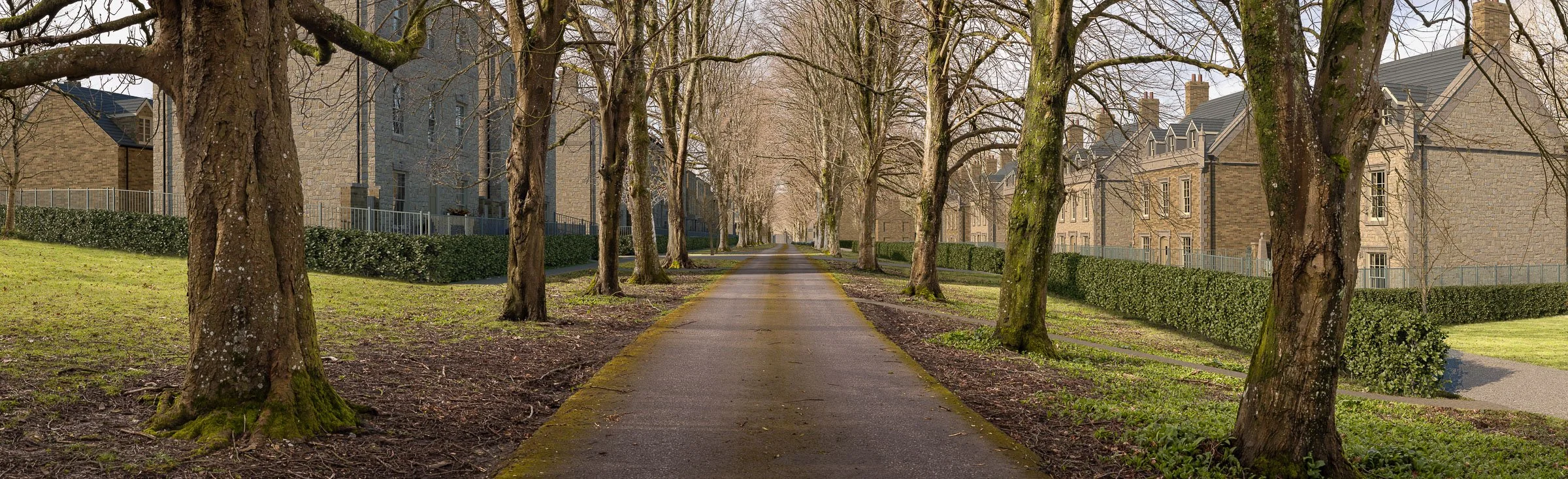
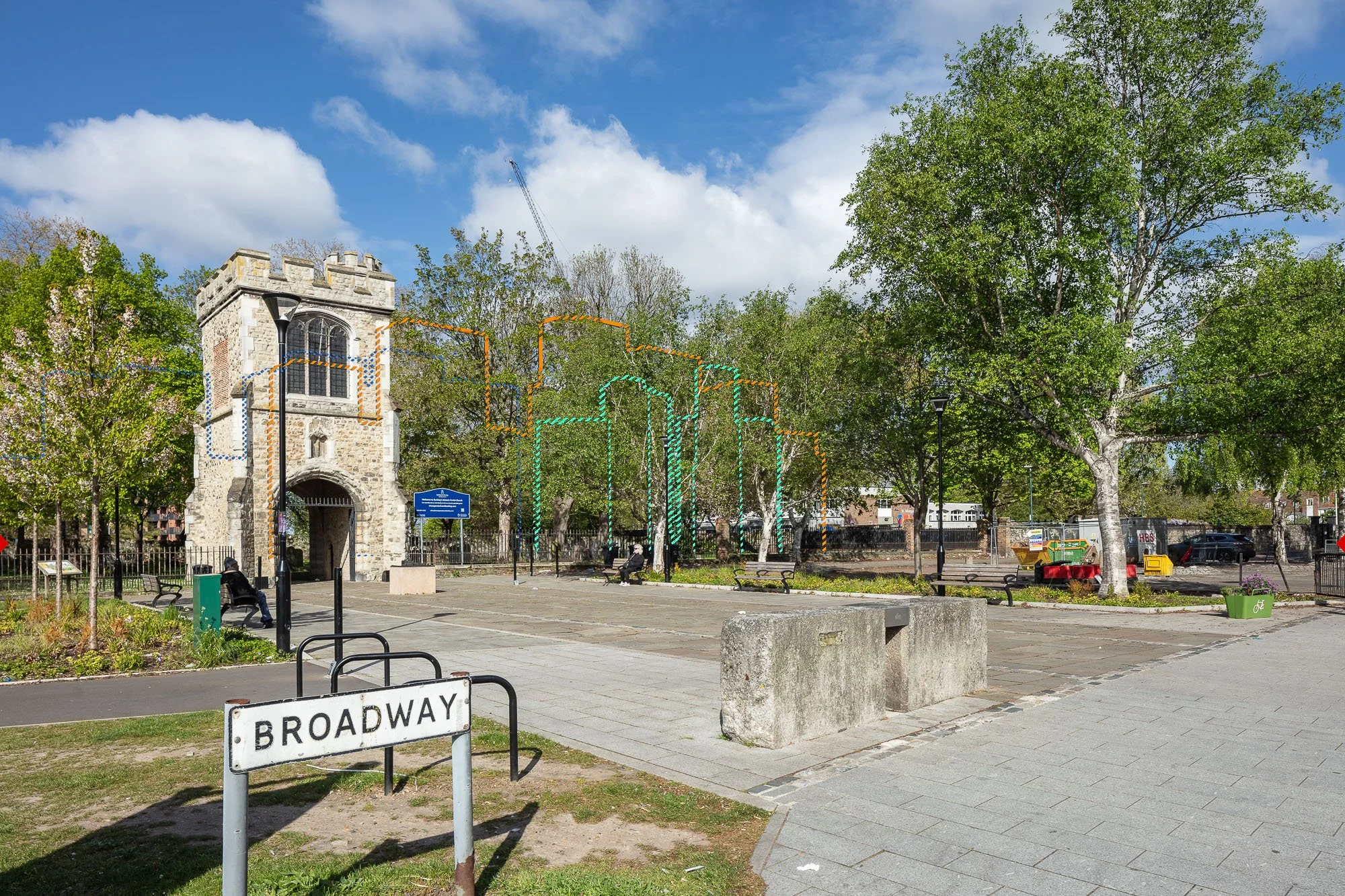
North Warmley Masterplan, South Gloucestershire
A major residential-led outline masterplan delivering up to 875 homes, alongside elderly accommodation and a mixed-use local hub. The submission required visual material capable of communicating parameter-based design rather than fixed architecture.
Our deliverables
6 × AVR1 Parameter Wirelines (panoramic views)
-
The primary challenge was communicating complex maximum parameter heights clearly and accessibly across a large and visually sensitive site. We developed a structured, colour-coded visual methodology to communicate multiple maximum building height parameters alongside indicative green infrastructure.
Vegetation was represented using wireline trees, hedges and scrub to illustrate planting at year one and an estimated 15-year growth scenario.
Across the project, detailed visibility assessment was required through dense tree cover, varied topography and a mixture of field, village and urban viewpoint settings.
Panoramic viewpoints were captured in accordance with Landscape Institute guidance to present the full context of the scheme. Accurate map interpretation and field location work ensured viewpoints aligned with early scoping photography and LVIA requirements. The verified visual package formed a compliant and coordinated evidence base supporting Stantec’s LVIA and strengthened the outline planning proposal.
Piccadilly Circus Screens
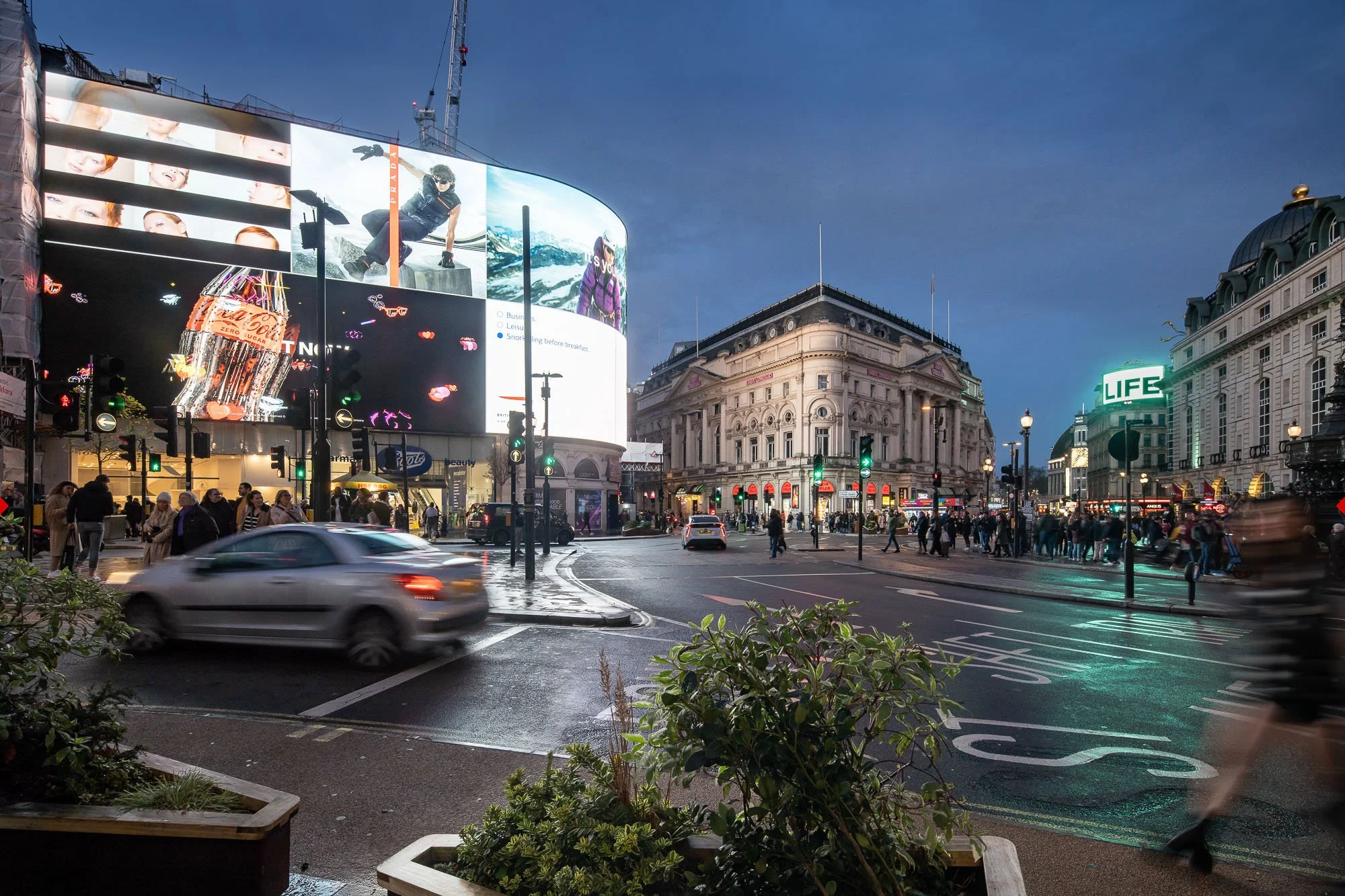
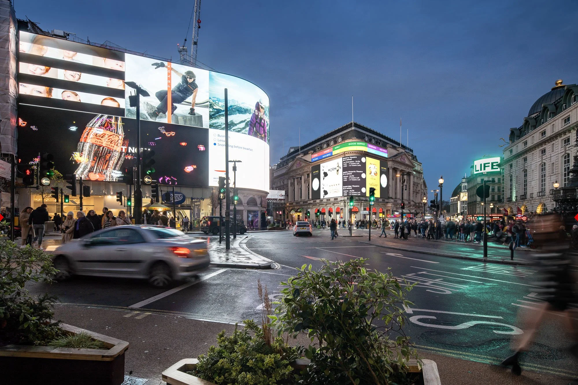
AVRs / Planning visualisations: preconstruct.com
Client: Criterion Capital Ltd
Planning consultant: Centro
Planning Stage: Planning permission granted, on appeal
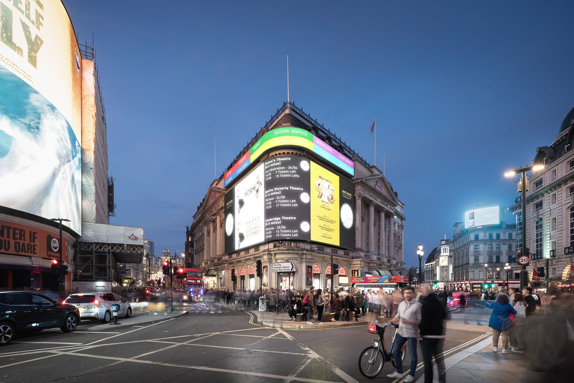
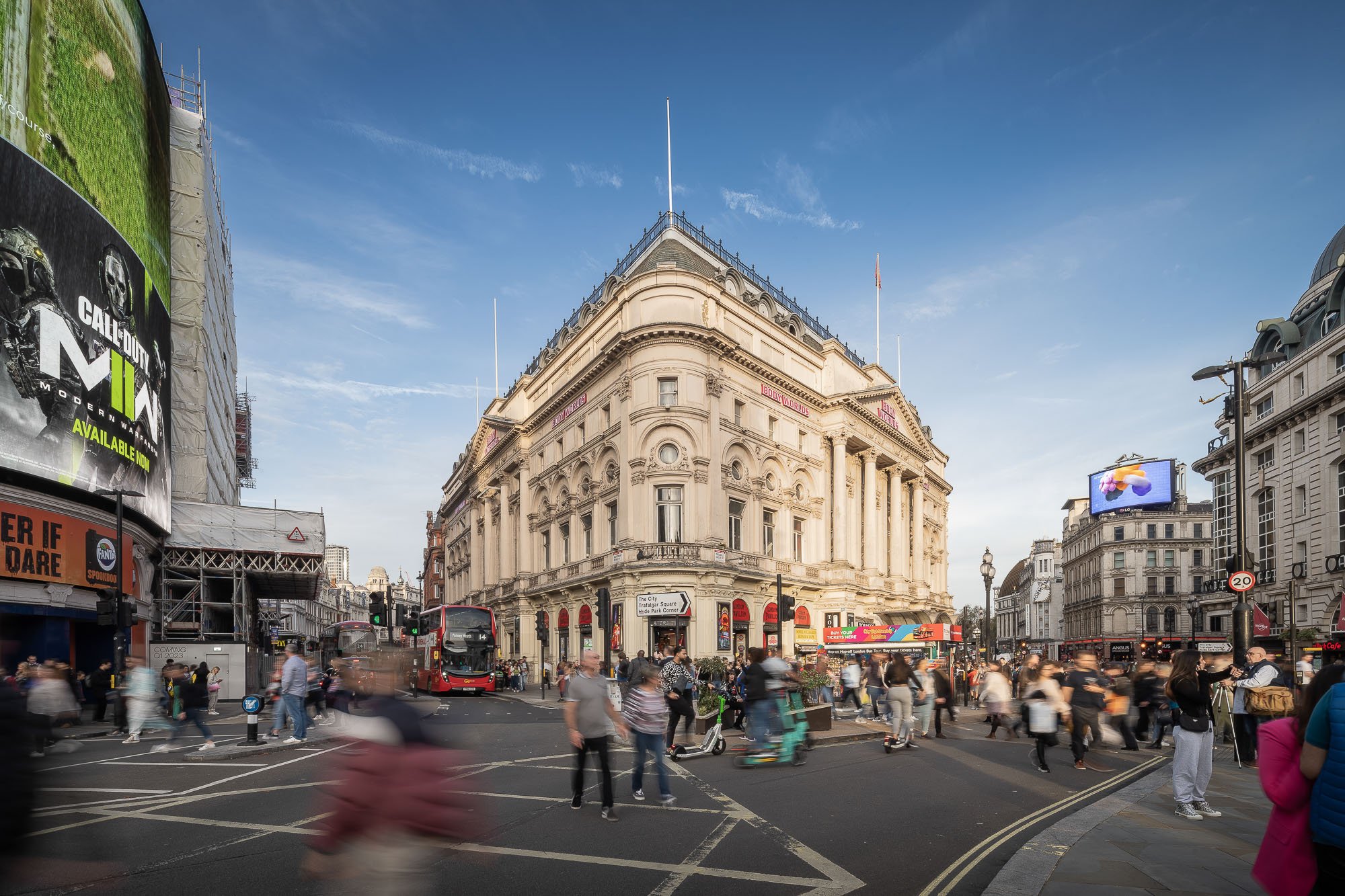
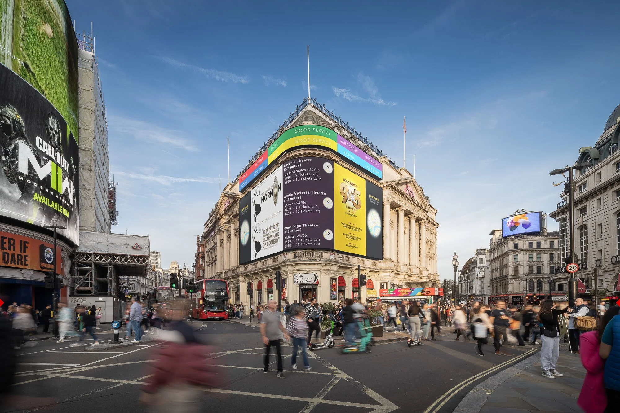
London Pavilion Digital Screens, City of Westminster
Proposal to install two large-format LED media screens across the façade of the Grade II-listed London Pavilion building, complementing the existing Piccadilly Lights and reinforcing the area’s historic role as a global centre for illuminated advertising.
The scheme required detailed heritage, townscape and public realm assessment within one of the UK’s most sensitive and internationally recognised commercial environments. Incorporating dedicated public-content broadcasting alongside commercial media, the proposal secured planning permission following a successful appeal.
Our deliverables
Planning film
AVR3s – Verified and non-verified photomontages and visuals
Night-time visualisations
-
The scheme required careful visual communication within one of the UK’s most scrutinised heritage and advertising environments. Communicating the impact of dynamic digital media within a heritage-sensitive setting required more than static visual evidence.
We supported early-stage consultation and stakeholder engagement by producing an engaging planning film combining historic footage, motion graphics, voiceover narration, on-location Piccadilly Circus footage and CGI sequences showing the proposed screens operating in context.
The film explained the historical evolution of illuminated advertising at the London Pavilion while demonstrating how the proposals would introduce contemporary digital media alongside public information and cultural programming. By presenting dynamic advertising content and public messaging in real-world context, the film helped audiences understand the intent and operation of the proposals at an early stage.
For the formal planning submission, we delivered AVRs and night-time visualisations, providing a robust visual evidence package that supported assessment of heritage impact, townscape integration and public realm visibility within a highly sensitive location.
The combined media approach enabled decision-makers to understand how the screens would function in real-world conditions rather than as a single static moment. This strengthened interpretation of visual impact and supported clearer planning justification within a complex and politically sensitive setting.
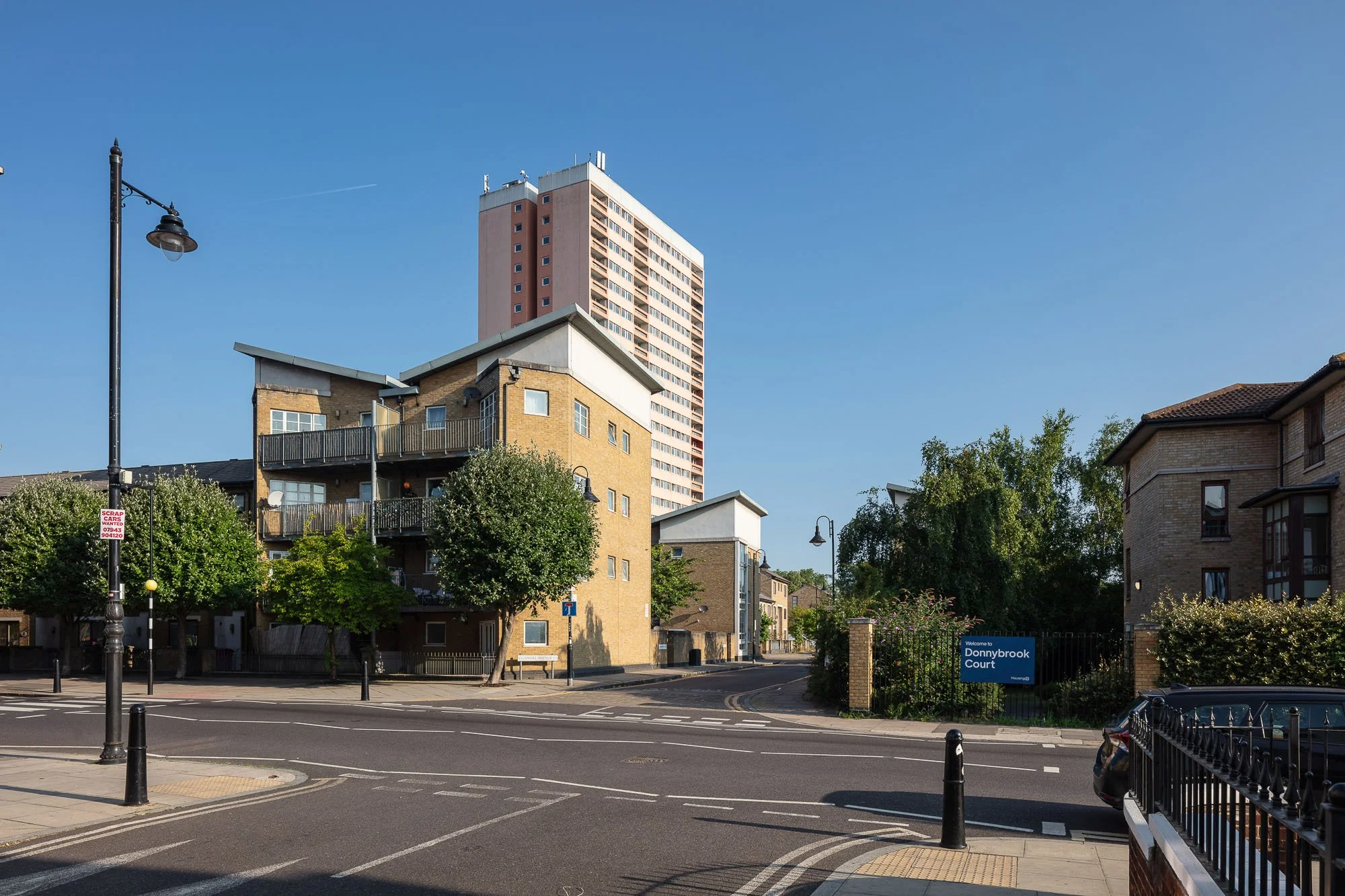
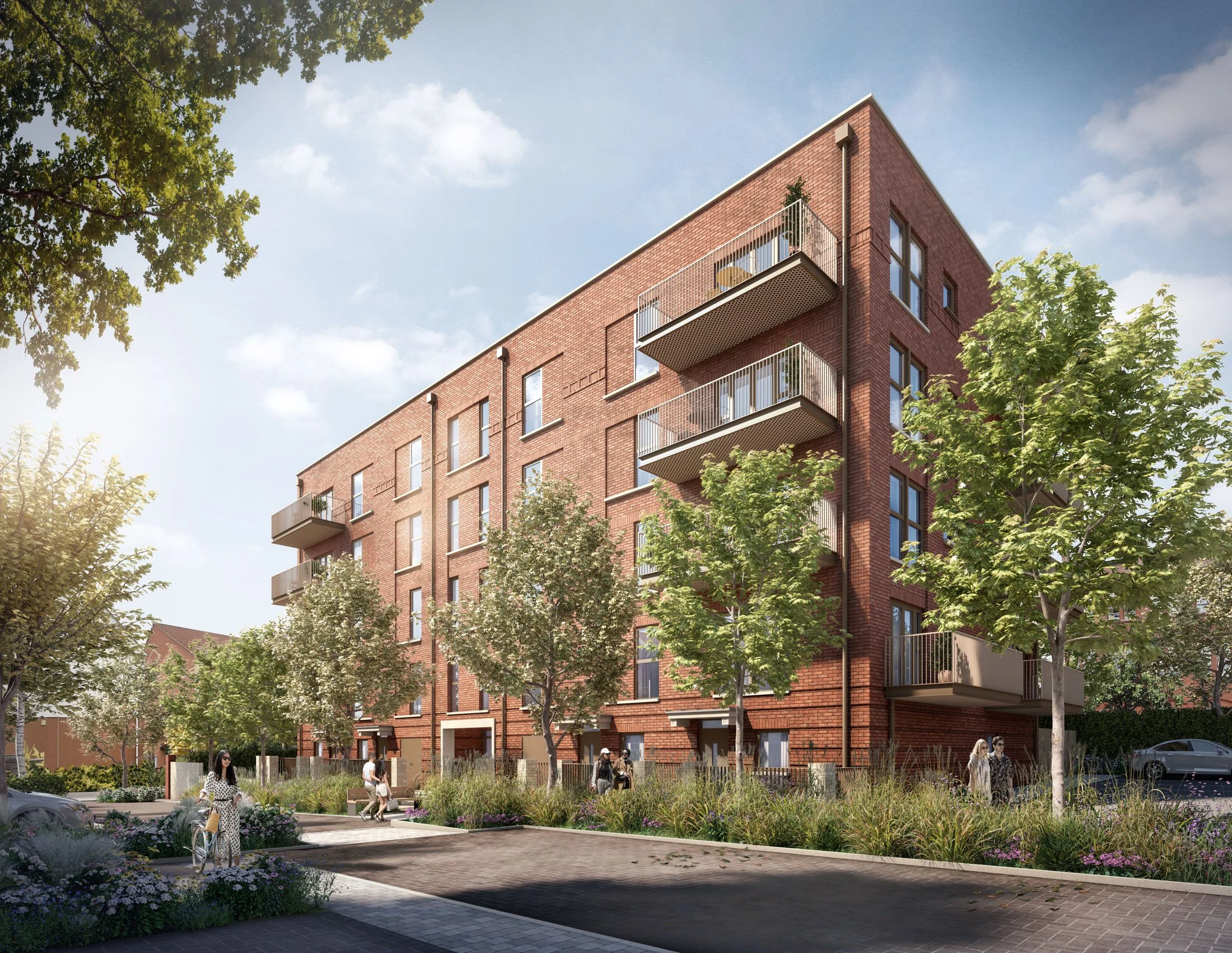
Clare House, Bow
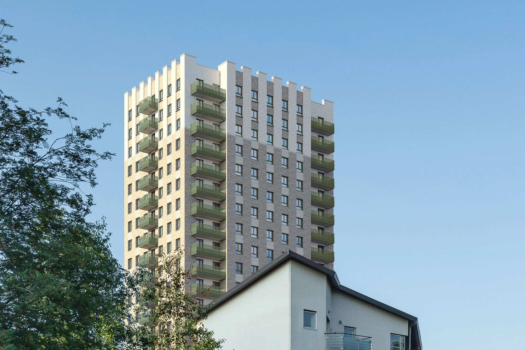
AVRs / Verified views: preconstruct.com
Developer: Clarion Housing Association
Planning Consultant & TVIA: Lichfields
Architect: HTA Design
Planning Stage: Planning approved
Clare House Residential Redevelopment, Bow
Redevelopment of the Clare House site delivering 145 new social rented homes alongside a new community facility within the London Borough of Tower Hamlets.
The approved scheme replaces the existing 22-storey tower with a new 23-storey residential building and adjoining 5 storey mansion blocks. Located close to Bow Road Station, the proposals provide a high proportion of family-sized homes, supporting affordable housing delivery and estate regeneration within a sensitive and established residential townscape.
-
Produced a comprehensive suite of AVRs supporting Lichfields’ Townscape and Visual Appraisal, providing accurate and verifiable visual evidence to translate policy-led analysis into clear and assessable views.
Supported assessment of visual impact from agreed public viewpoints and assisted evaluation of effects on nearby heritage assets and their settings by illustrating change within real-world context.
Strengthened alignment between written townscape analysis and visual material, improving clarity, increasing confidence in the evidence base and helping identify and address potential visual concerns.
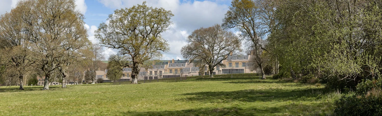
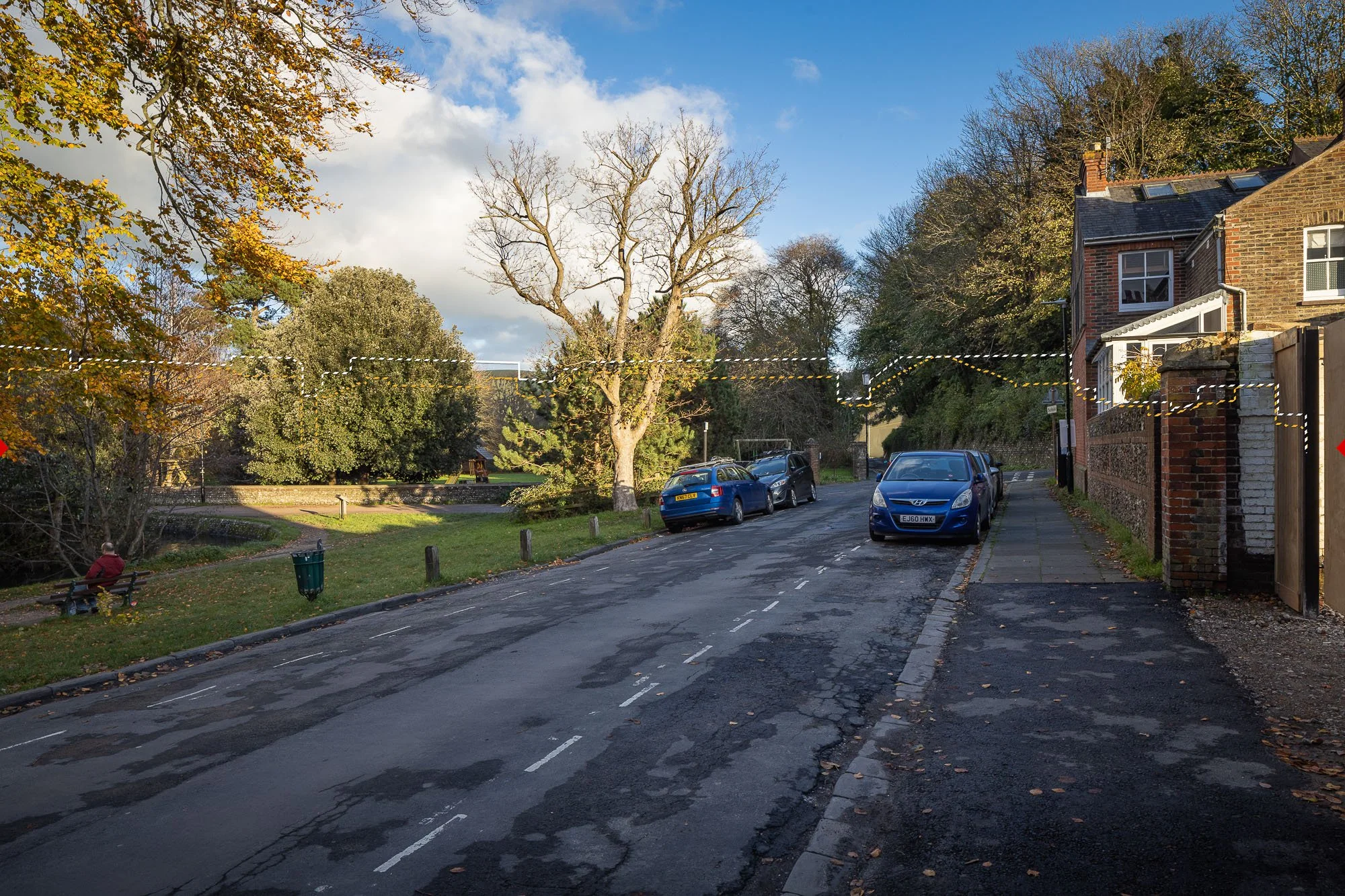
Parnham Park, Dorset
AVR / Verified views: Preconstruct.com
Client: Parnham Park Estate
Planning Consultant: Tor & Co
Architect: DHA
Landscape & LVIA: Arc Landscape Design and Planning
Planning Stage: Application made late 2025
Parnham Park heritage restoration enabling development, Dorset
Parnham Park is a historically significant estate centred around a fire-damaged listed Tudor manor set within a registered historic parkland landscape in Dorset. The proposals form an enabling residential development designed to support long-term restoration of the estate. Verified visual evidence was essential to communicate potential impacts and support planning dialogue.
Our deliverables
10 × AVR1 Wirelines
6 × AVR3 Rendered Views
(Panoramic views)
-
The project required a highly robust and transparent visual evidence base due to heritage sensitivity and strong community interest. We worked closely with the LVIA consultant and design team to establish representative viewpoints and capture comprehensive baseline photography.
AVR1 photowires provided verified linework of the proposed houses. AVR3 rendered realistic views showed the proposed houses, landscaping, planting and trees — all faithfully integrated into the existing context. Careful viewpoint selection was critical, capturing a range of views from public rights of way, from within the estate, and across the wider Dorset Area of Outstanding Natural Beauty (AONB). Through this approach, we helped reduce ambiguity for planners, consultees and local stakeholders, strengthening confidence in the consultation process.
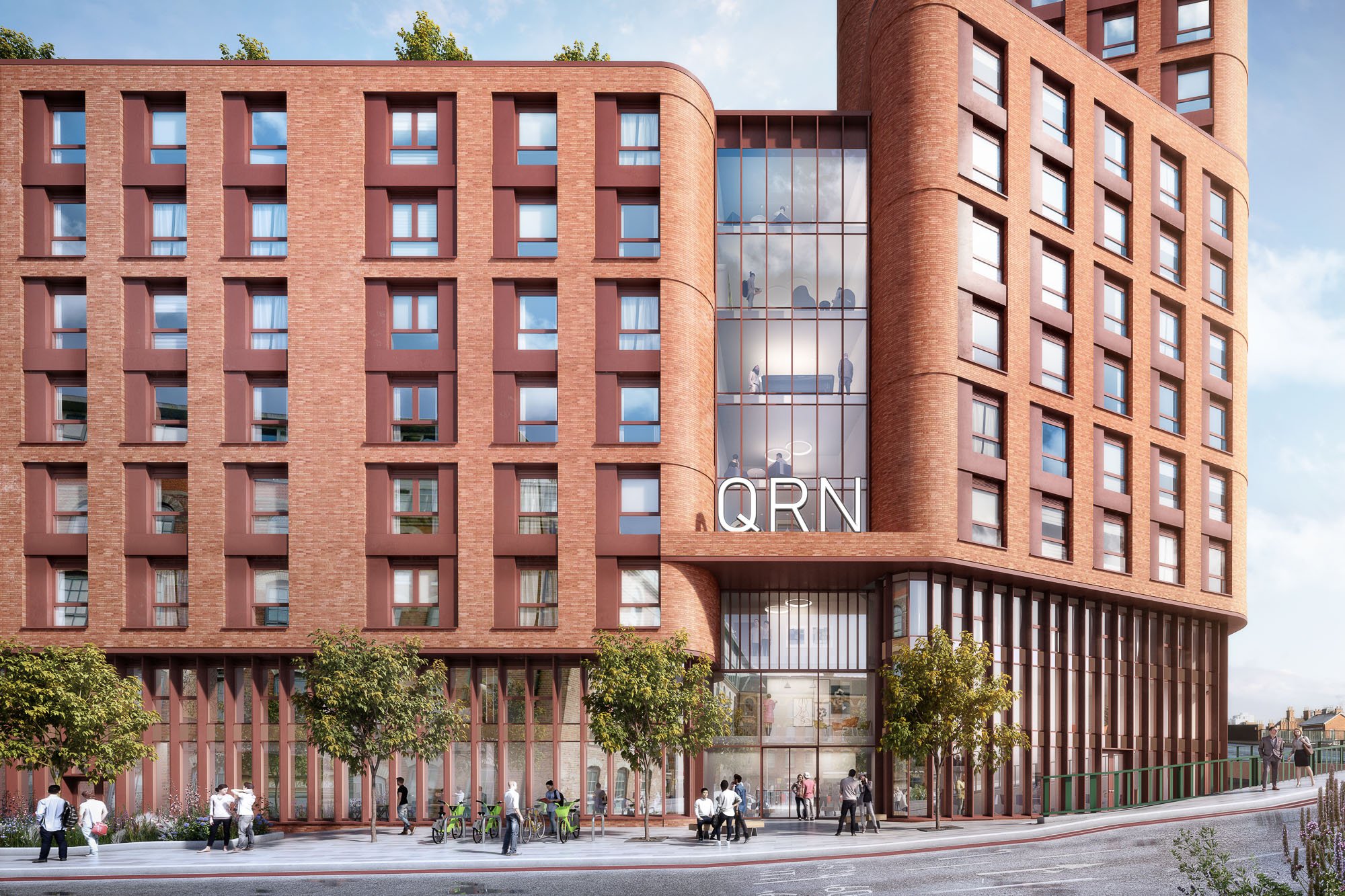
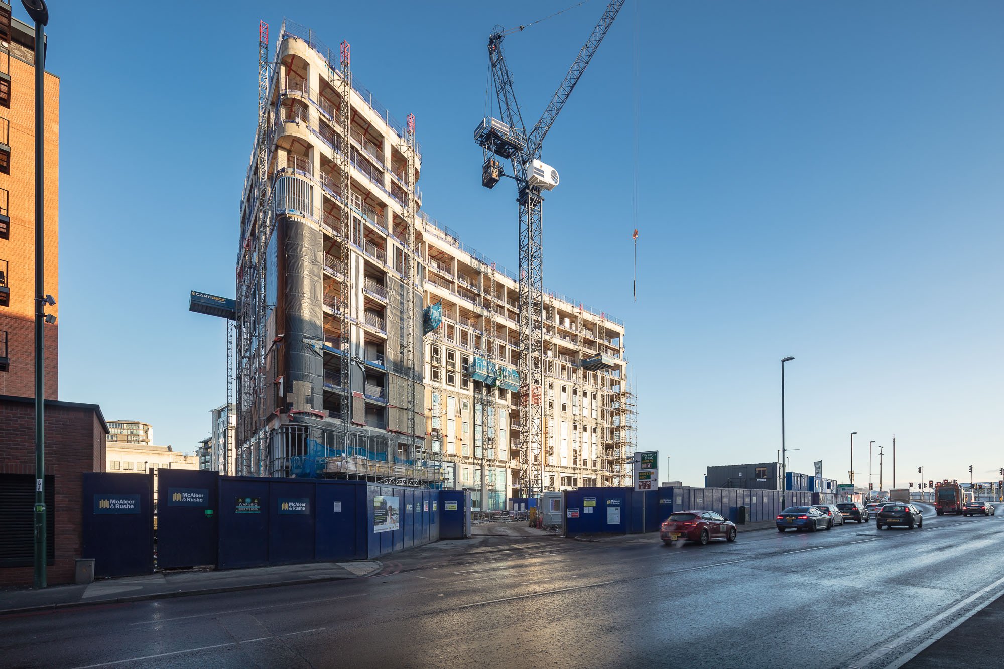
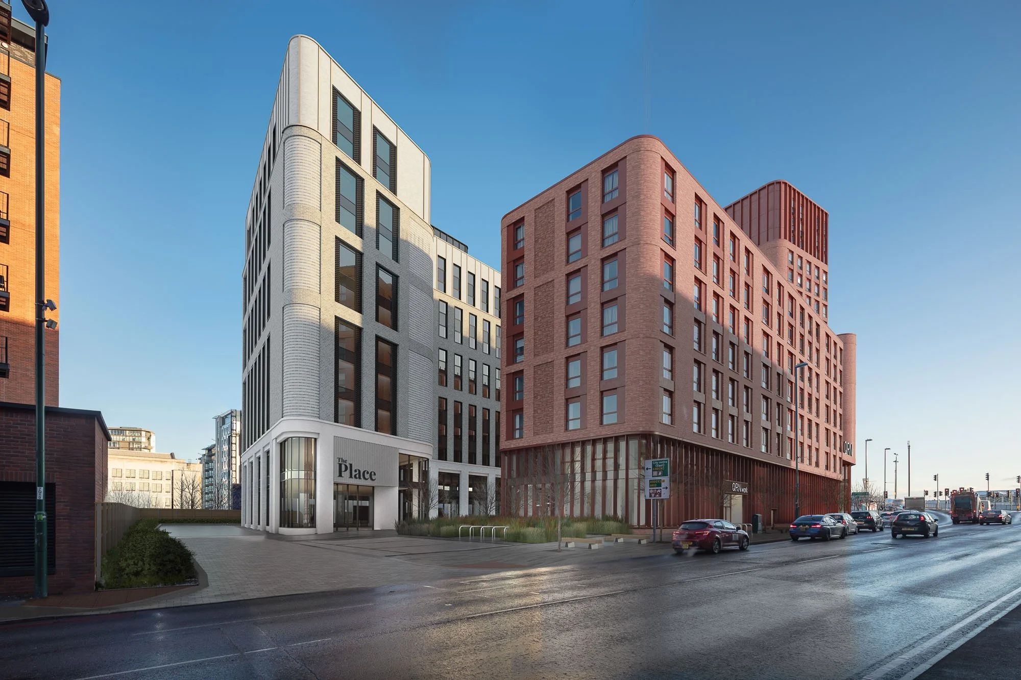
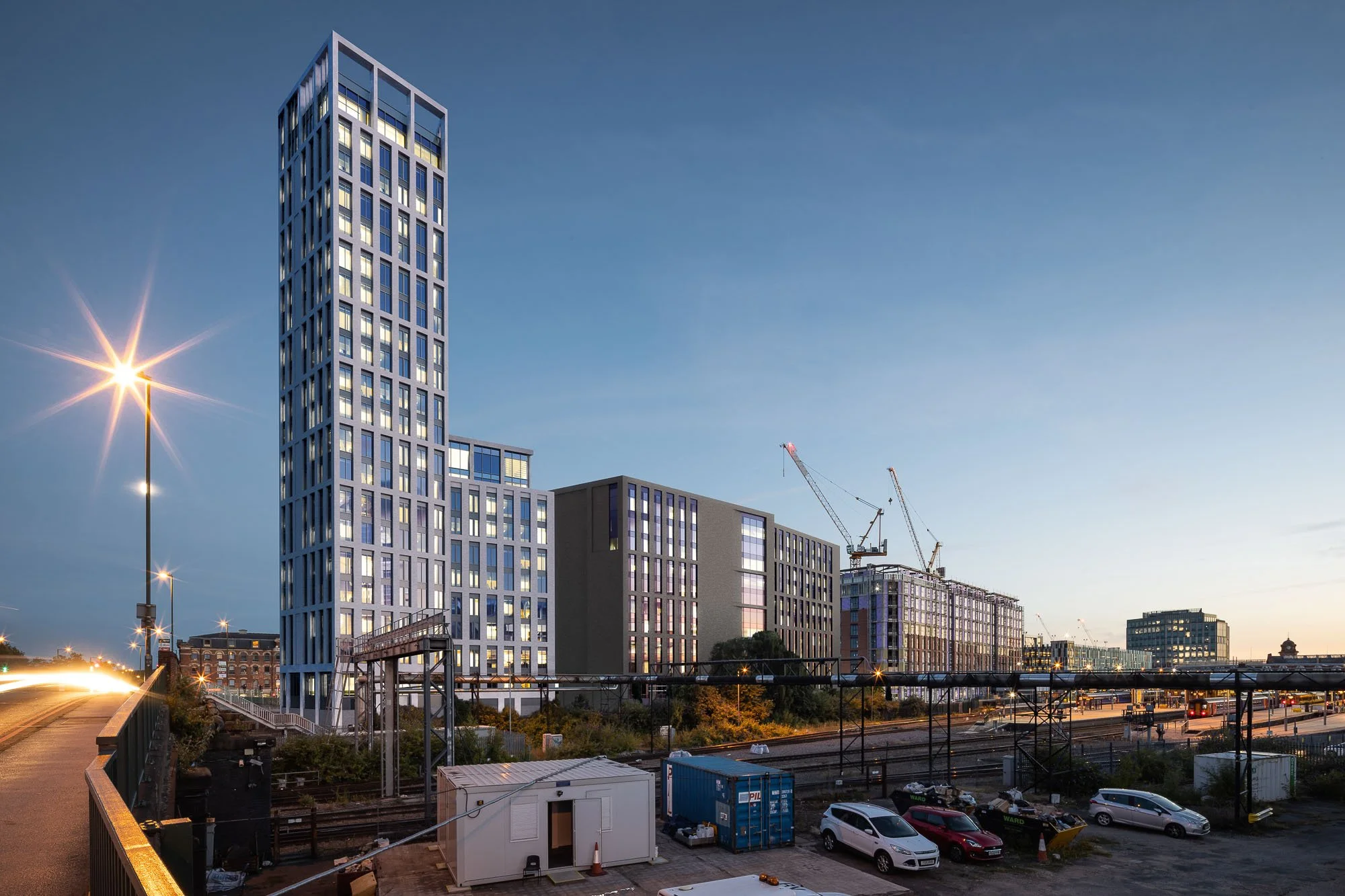
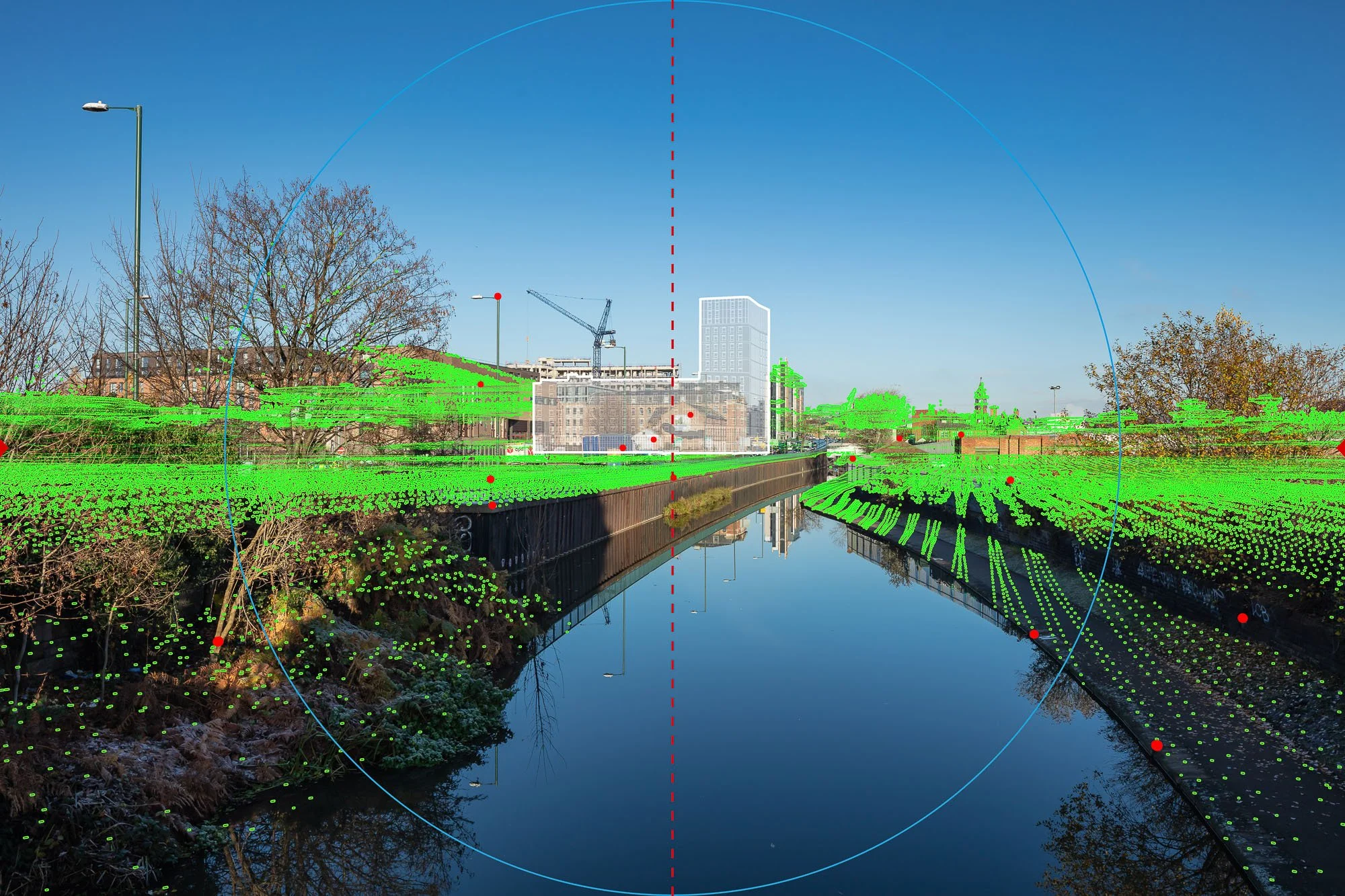
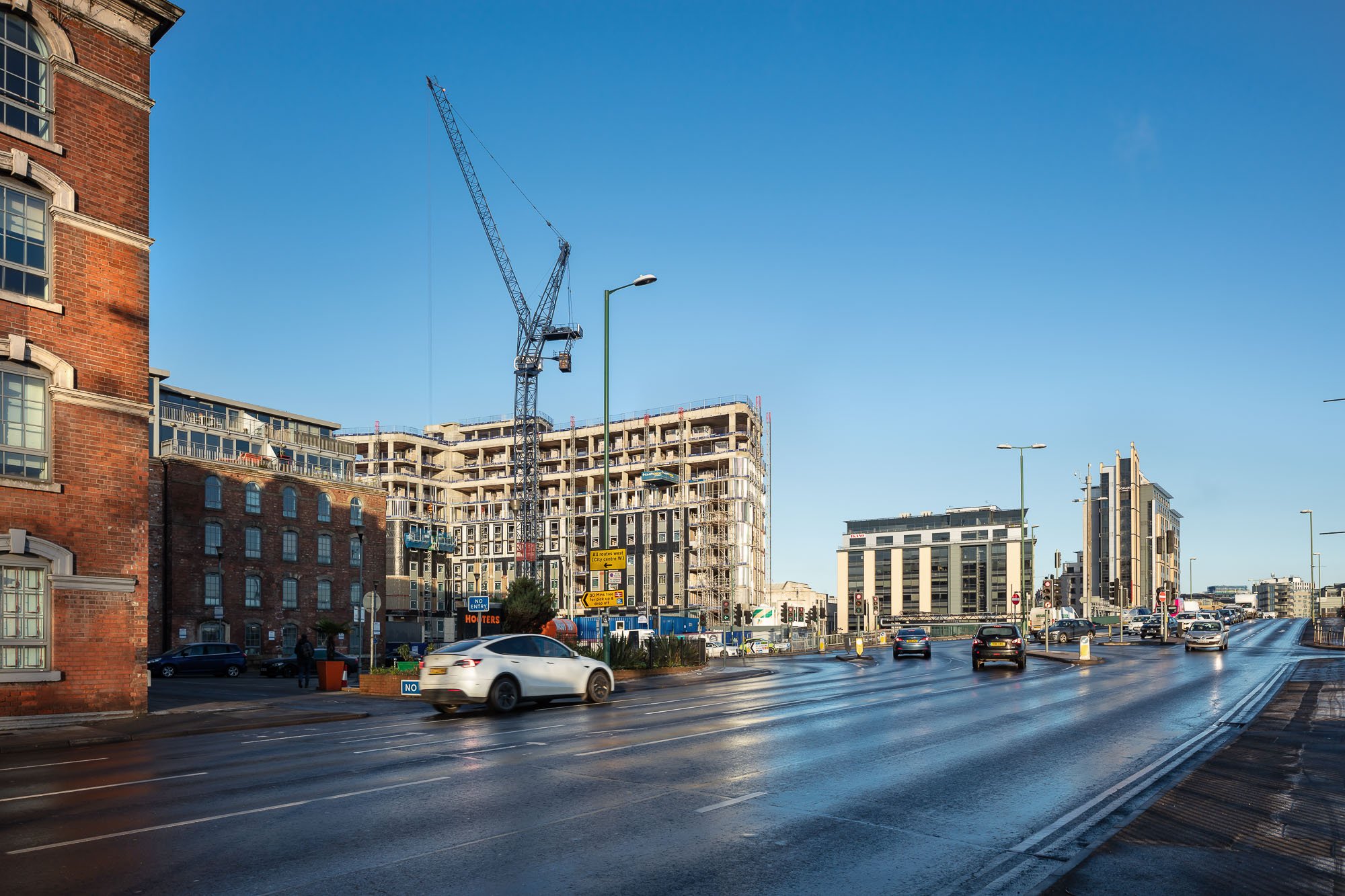
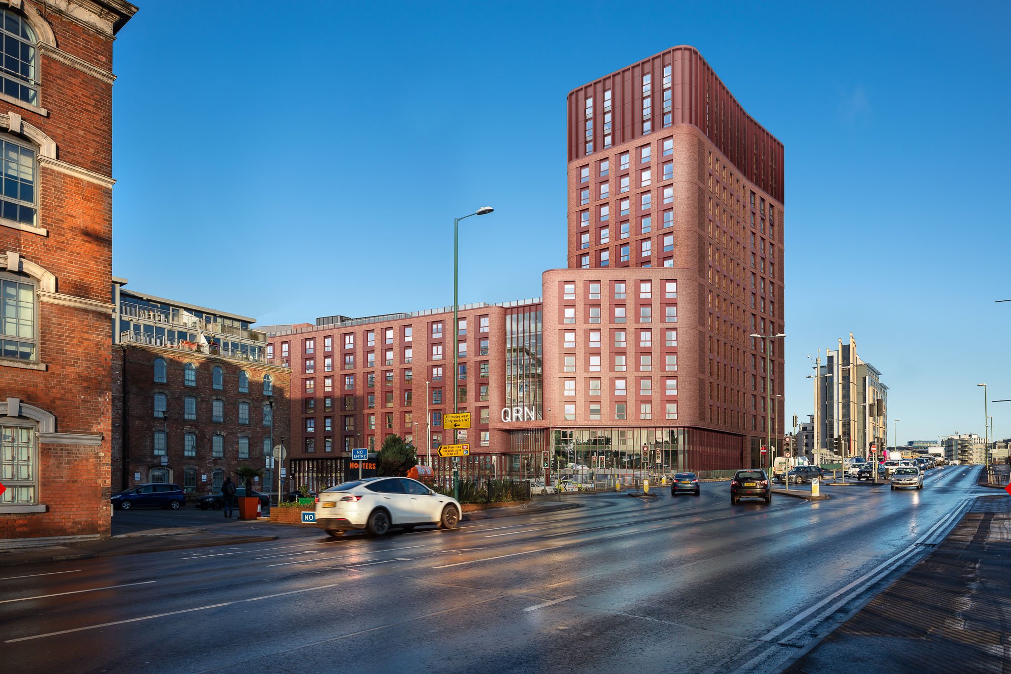
Queens Rd, Nottingham
AVRs / Planning visualisations: preconstruct.com
Developer: McAleer & Rushe
Planning Consultants & TVIA: Lichfields & FPCR
Architect: Consarc Design
Landscape: Parkhood
Planning Stage: Planning Granted
Queens Road Residential Tower Phase Two, Nottingham
Phase Two redevelopment delivering a tall residential building within an evolving city context. The scheme forms part of a wider regeneration masterplan and required visual material capable of supporting both planning assessment and stakeholder engagement across a long project programme.
Our deliverables
Multiple iterations of:
10 × AVR1 Wirelines (including cumulative schemes)
3 × AVR3 Rendered Views (including cumulative schemes)
Supporting Planning/Marketing CGIs (Non-Verified)
-
Supported an evolving application over time, capturing updated photography as the surrounding city context changed and ensuring cumulative assessment remained accurate.
Produced highly precise AVR1 and AVR3 views, alongside block models of consented schemes, enabling reliable skyline testing within a rapidly developing urban setting.
Delivered both verified and non-verified imagery to support planning assessment and the DAS, helping the team communicate scale, massing and architectural intent while maintaining a robust evidence base.
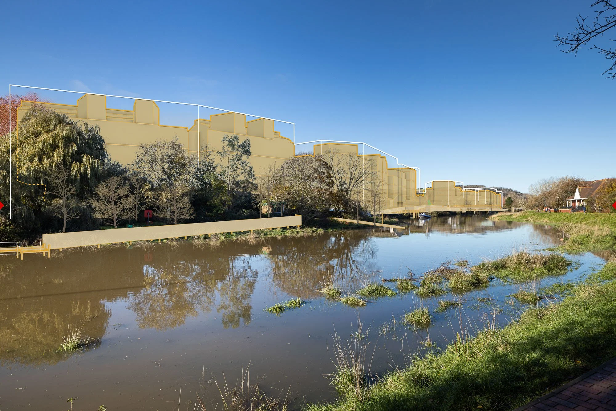
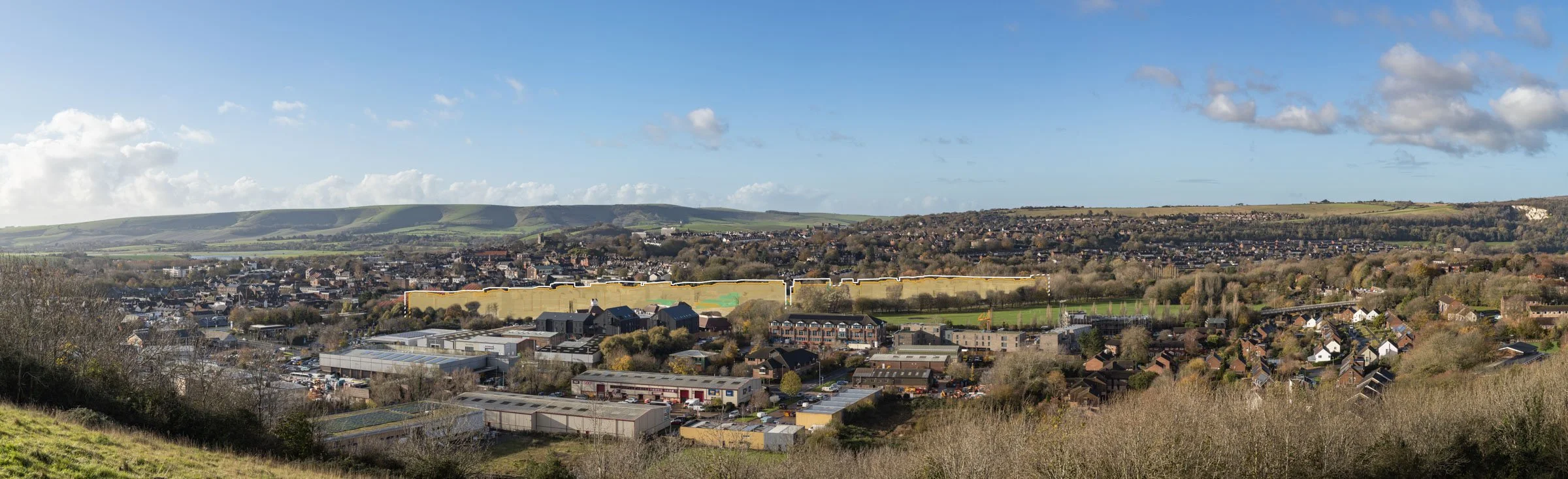
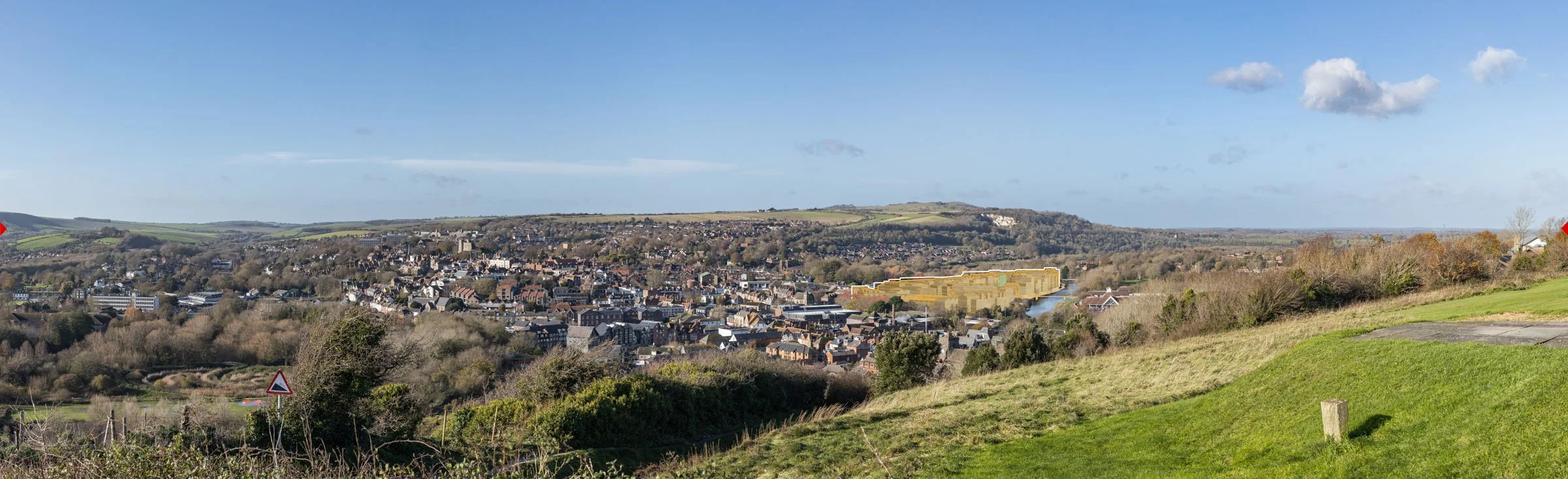
Lewes Masterplan
AVRs / Verified views: preconstruct.com
Developer: Human Nature
Architect: Periscope
Landscape & VIA: Terra Firma
Planning Stage: Granted subject to section 106 & Highways matters
Lewes Phoenix Regeneration Masterplan, East Sussex
Large-scale regeneration masterplan within a highly sensitive historic town and landscape setting requiring extensive parameter-based visual evidence to support planning submission and stakeholder engagement.
Our deliverables
30+ AVR1 Wirelines
Including panoramic views
More info
www.phoenixlewes.com
-
Produced a comprehensive suite of 30 AVRs, delivering a robust and transparent visual evidence base proportionate to the scale and sensitivity of the masterplan.
AVR1 wirelines clearly communicated maximum parameter heights alongside illustrative design proposals, enabling decision-makers to distinguish between worst-case envelopes and likely built form.
Used panoramic views for longer-distance viewpoints to ensure the full extent of the masterplan could be understood within the wider setting of the South Downs National Park, avoiding fragmented or partial representation. These panoramics supported assessment of scale, spread and landscape containment across sensitive receptors.
Applied 24mm focal length views within the town to allow accurate and legible assessment of massing, height and pedestrian-level townscape relationships.
Established a clear and compliant image methodology, addressing uncertainty created by earlier visuals and supporting constructive dialogue with the council. This strengthened confidence in the visual material and enabled a more objective assessment of landscape and townscape effects.
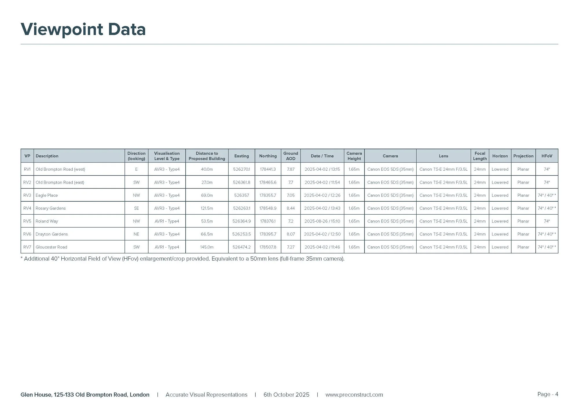
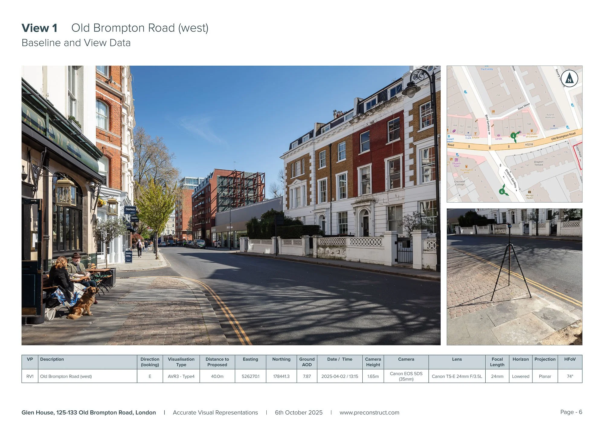
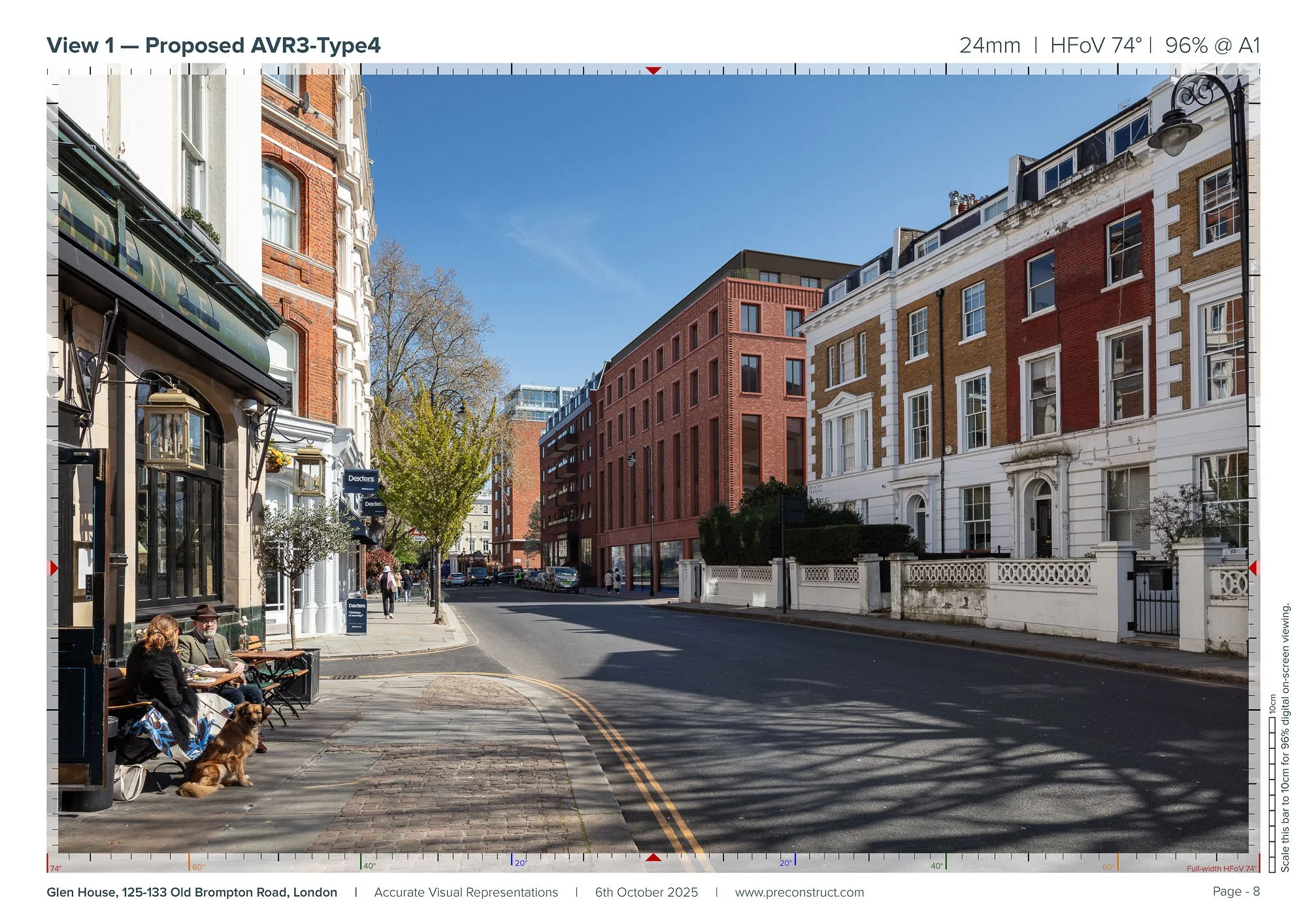
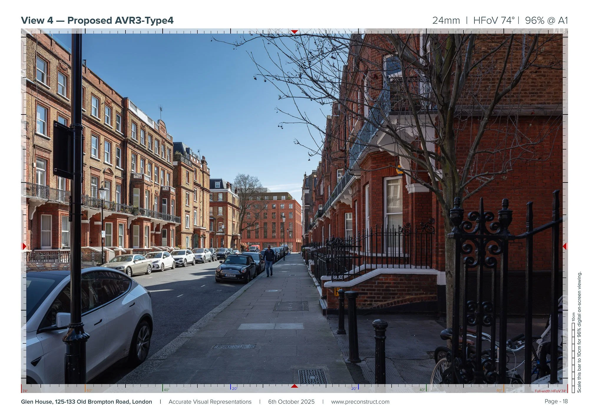
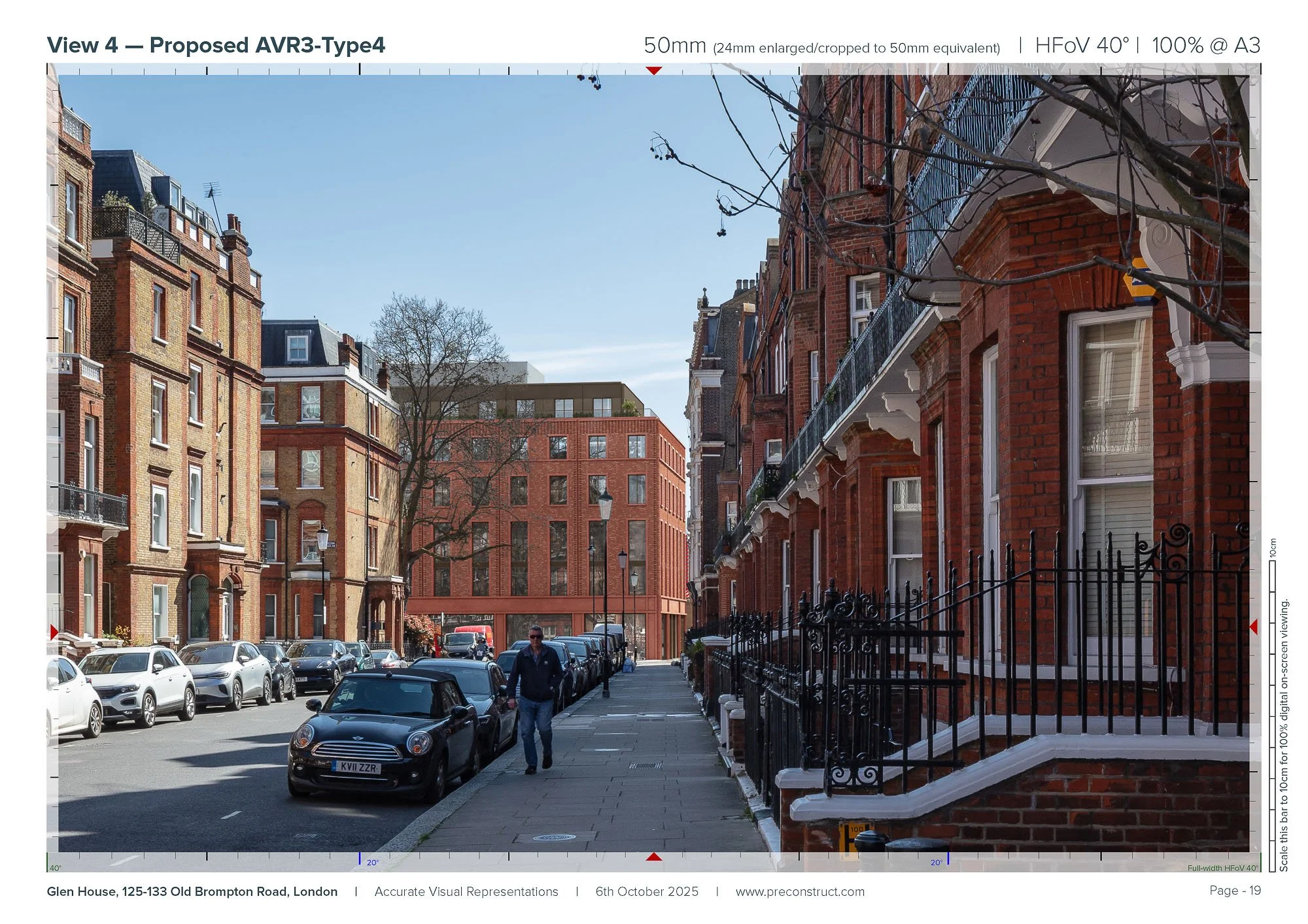
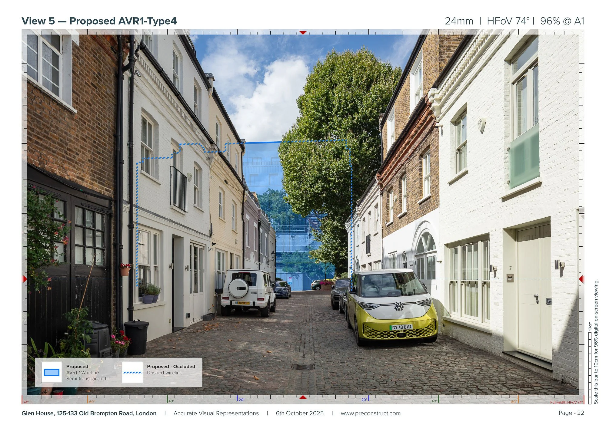
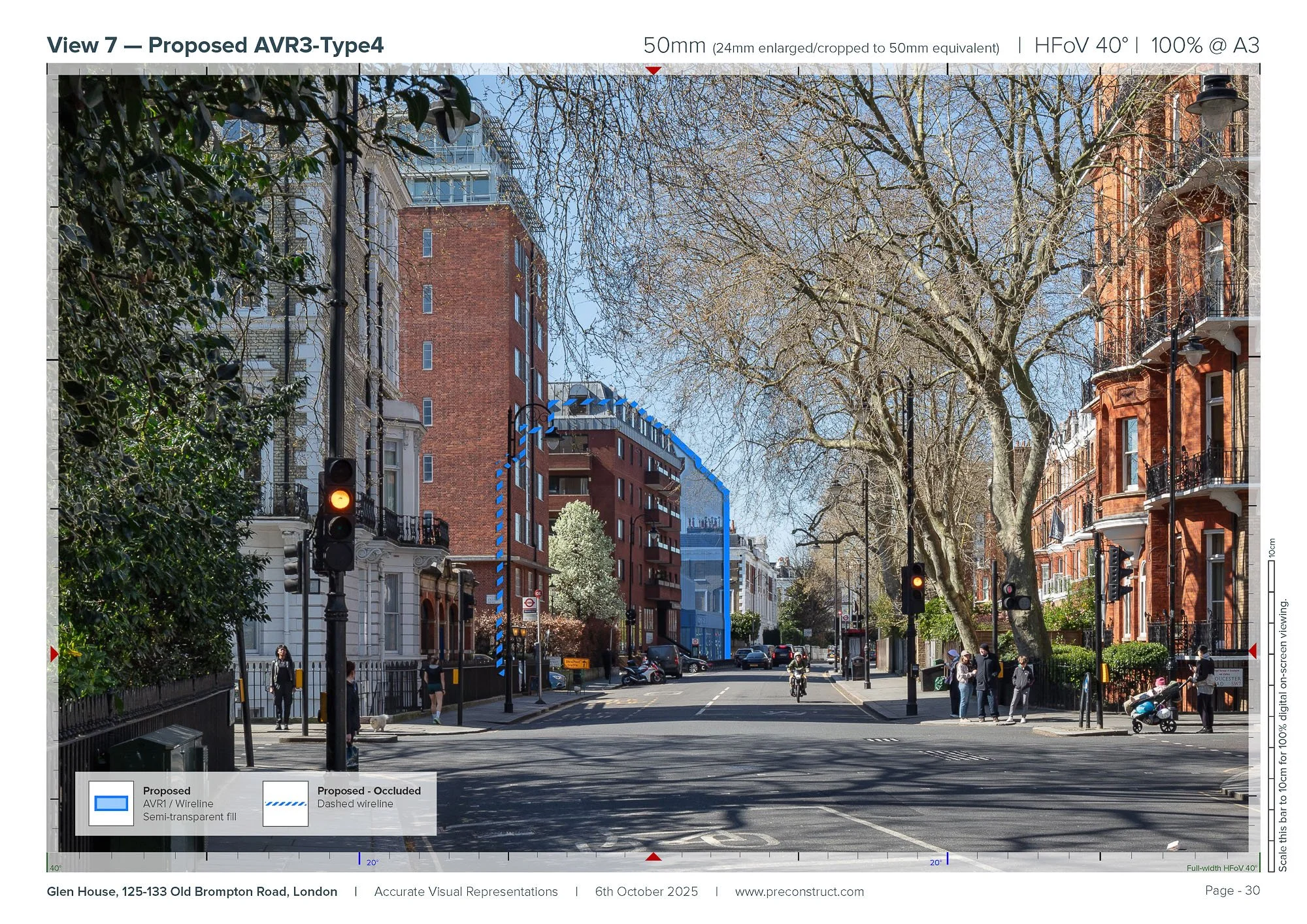
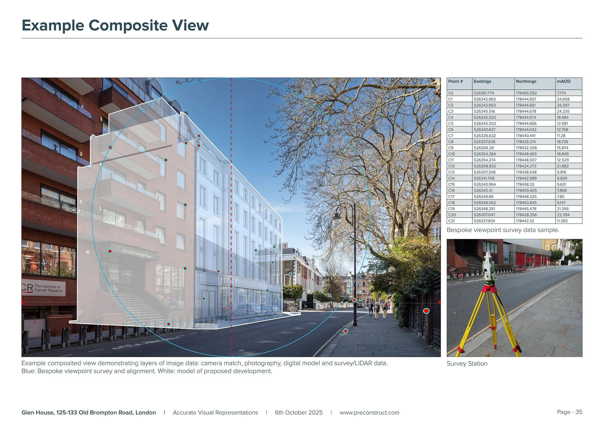
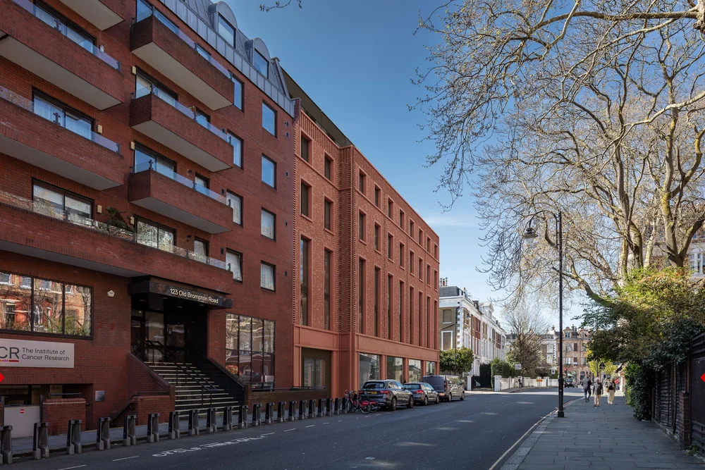
Glen House, South Kensington
AVRs / Verified views: preconstruct.com
Developer: Glen House Development LLP
Architect: Ryder Architecture
Planning Consultant & TVIA: Turley
Planning Stage: Submitted 2025
Glen House Redevelopment, South Kensington
Urban redevelopment within a tightly constrained South Kensington townscape where accurate interpretation of scale, façade presence and street-level experience was critical to planning assessment.
Our deliverables
2 × AVR1 Wirelines
5 × AVR3 Rendered Views
-
Supported an evolving brief with additional views introduced later in the programme. We carried out a thorough photography campaign covering an extended long-list of potential viewpoints, with on-the-ground decisions made during the shoot to work around physical obstacles and provide alternative options where required.
Undertook bespoke viewpoint surveys to achieve the high level of alignment accuracy required for a close-range urban townscape setting.
Produced AVR3 views that communicated the proposed brick variation and façade detailing with clarity and realism, supported by extremely high-resolution 24mm views with 50mm equivalent crops to improve guidance compliance while retaining sufficient contextual coverage.
Delivered outputs to support a timely planning submission, including draft visuals to assist early report writing.
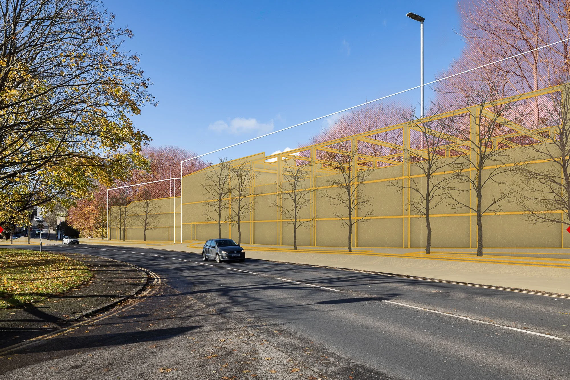
Frasers Group HQ, Rugby
Planning visualisations: preconstruct.com
Client: Frasers Group
Planning Consultant: Quod
Architect: Grimshaw / SMR
Landscape & LVIA: LUC
Planning Stage: Granted
Frasers Group Headquarters Campus, Rugby Borough
A new headquarters campus incorporating offices, retail, education and hospitality uses set within a large landscaped setting. The planning submission and consultation required visual material capable of communicating how the campus would be experienced from surrounding transport routes and public viewpoints.
Our deliverables
2 x Driver-Perspective Flythrough Animations
-
Static viewpoints alone could not fully communicate how the campus would be experienced during everyday movement. We developed route-based driver-perspective animations to illustrate sequential visibility and real-world journey experience across key surrounding roads.
Winter scenario modelling was incorporated to provide a conservative and realistic reading of landscape screening, strengthening credibility of the visual assessment. The animation package supported planning evaluation by bridging technical analysis with intuitive stakeholder understanding of how the development would be perceived in practice.
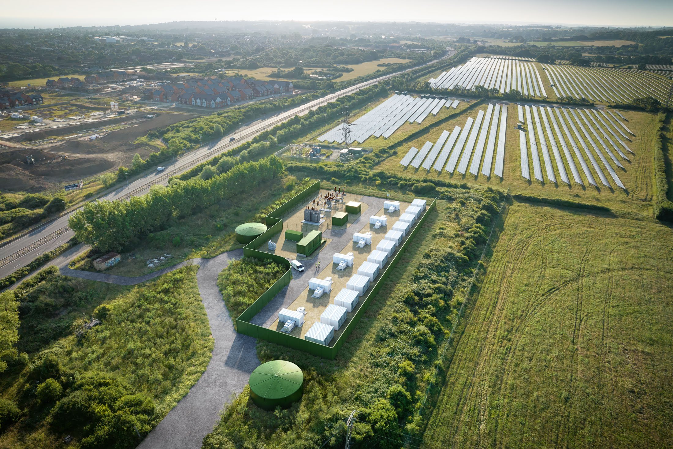
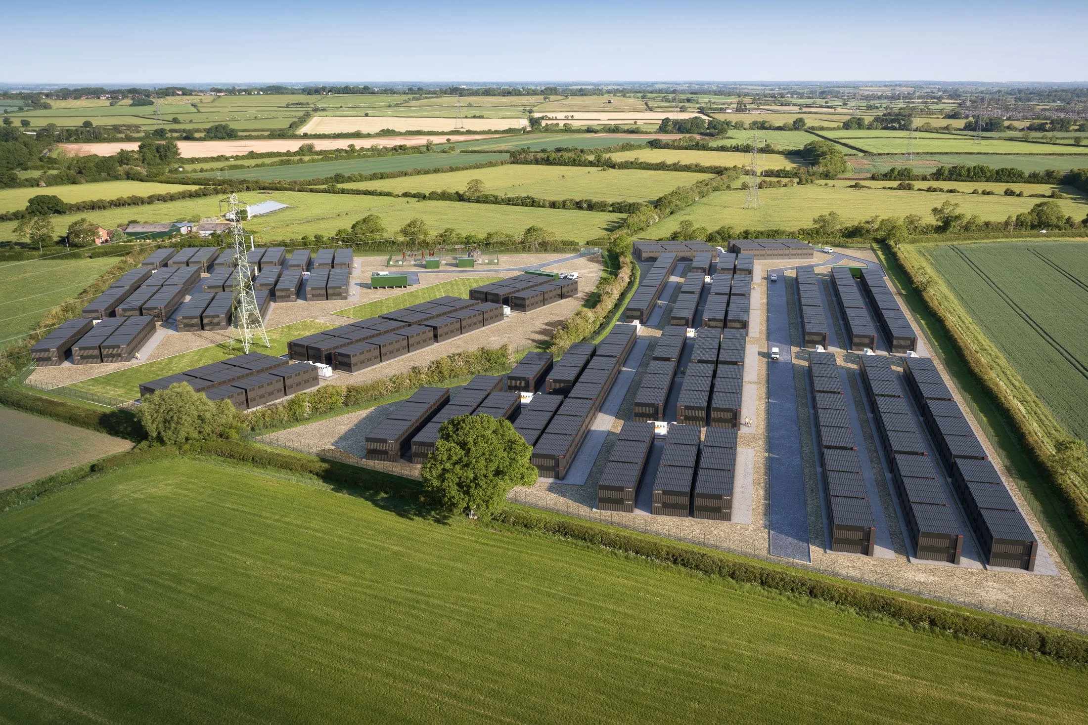
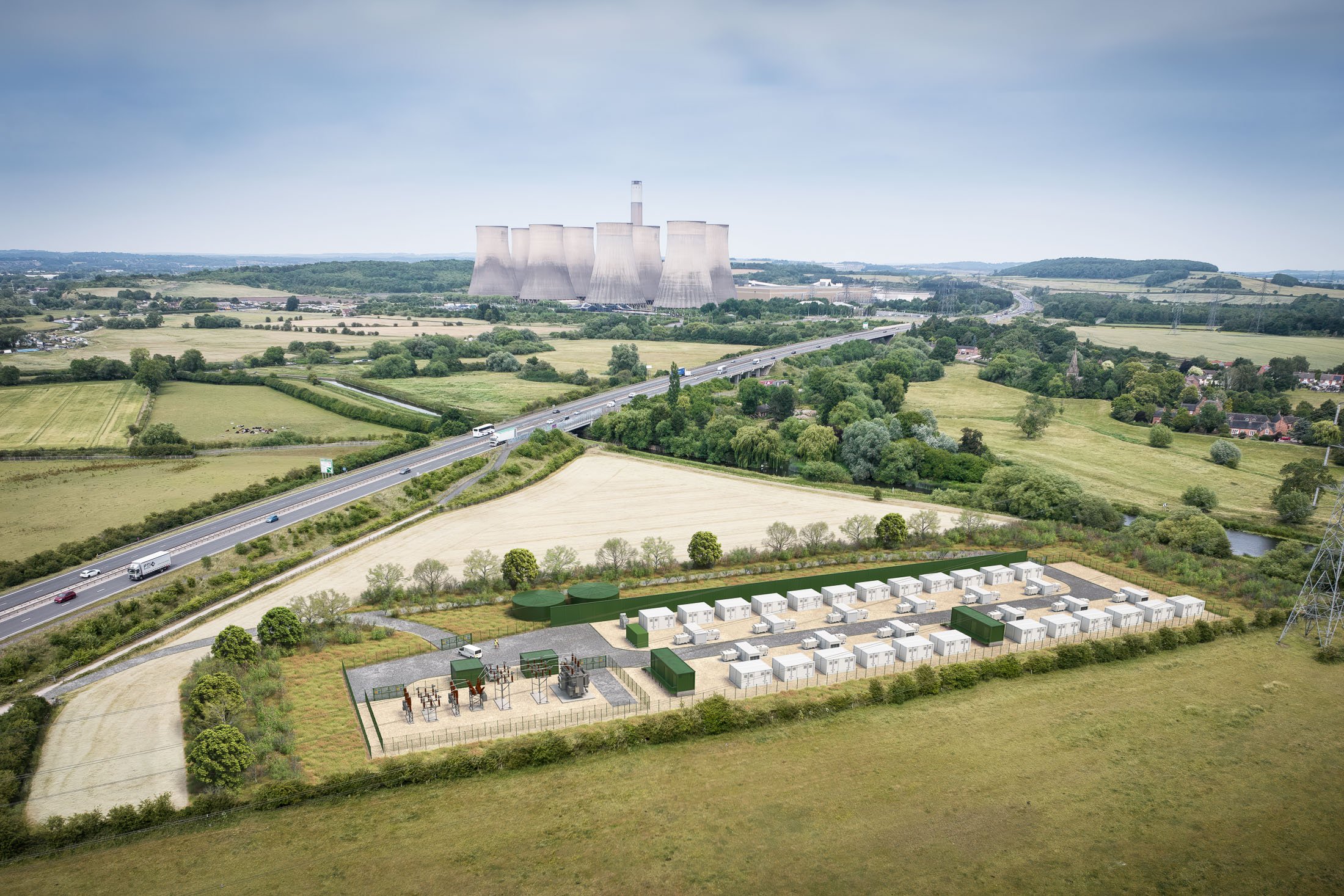
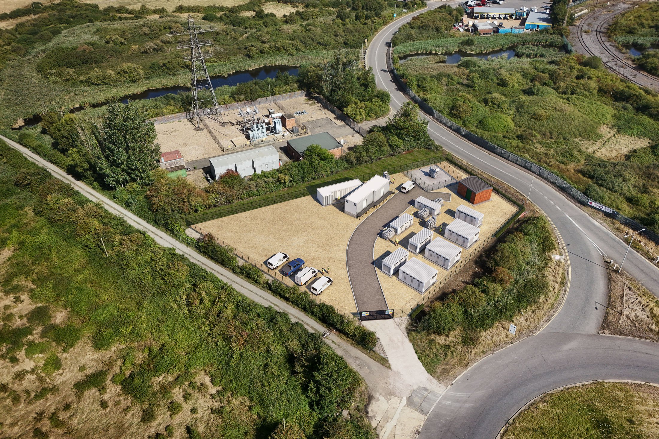
Root Power BESS, UK-wide

Planning photomontages & drone views: preconstruct.com
Client: Root Power
Planning Consultant: RCA Regeneration
Landscape & LVIA: LVIA Ltd
Planning stage: Multiple sites consented (England & Scotland)
Root Power – Battery Energy Storage Systems (BESS)
Root Power develops, builds, owns and operates battery energy storage projects across the UK. We have supported 20+ BESS planning applications across England and Scotland, producing clear, planning-focused photomontages that help communicate site layout, scale and landscape context for both consultation and submission stages.
Our deliverables
Bespoke drone photography + CGI drone photomontages
Accurate eye-level photomontages
-
Across 20+ Root Power BESS projects in England and Scotland, the challenge was clearly communicating how each proposal would sit within its real landscape context — from close views at the site edge to wider perspectives showing surrounding infrastructure and landform.
We delivered a consistent approach using bespoke drone photography and CGI photomontages to show layout, access and screening clearly, while responding to the specific character of each location. For example, Lucky Star near Herne Bay in Kent sits within an existing energy landscape alongside solar farms, pylons and a substation; the A645 scheme in West Yorkshire is tightly contained between the railway and the A645 corridor; Knuzden near Blackburn occupies disused land influenced by overhead lines and motorway infrastructure; and River Soar in Leicestershire runs alongside the river corridor within a landscape of varied habitats.
Where required for LVIA, we also produced accurate eye-level photomontages from agreed viewpoints, helping planners and consultees judge visibility, scale and the effectiveness of proposed landscaping. The resulting visuals supported planning clarity and provided Root Power with high-quality imagery for wider consultation and communications.
Crescent, Bristol


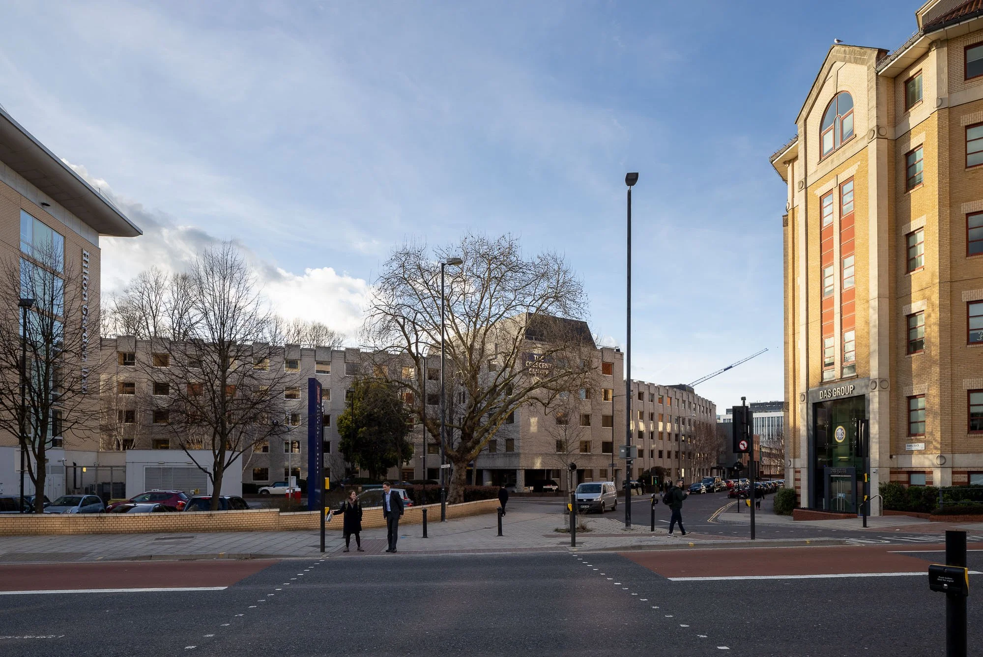
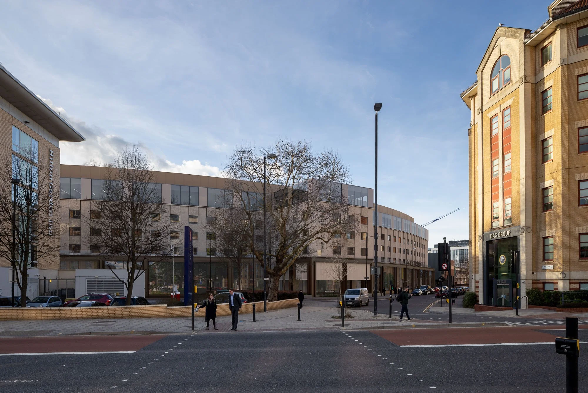
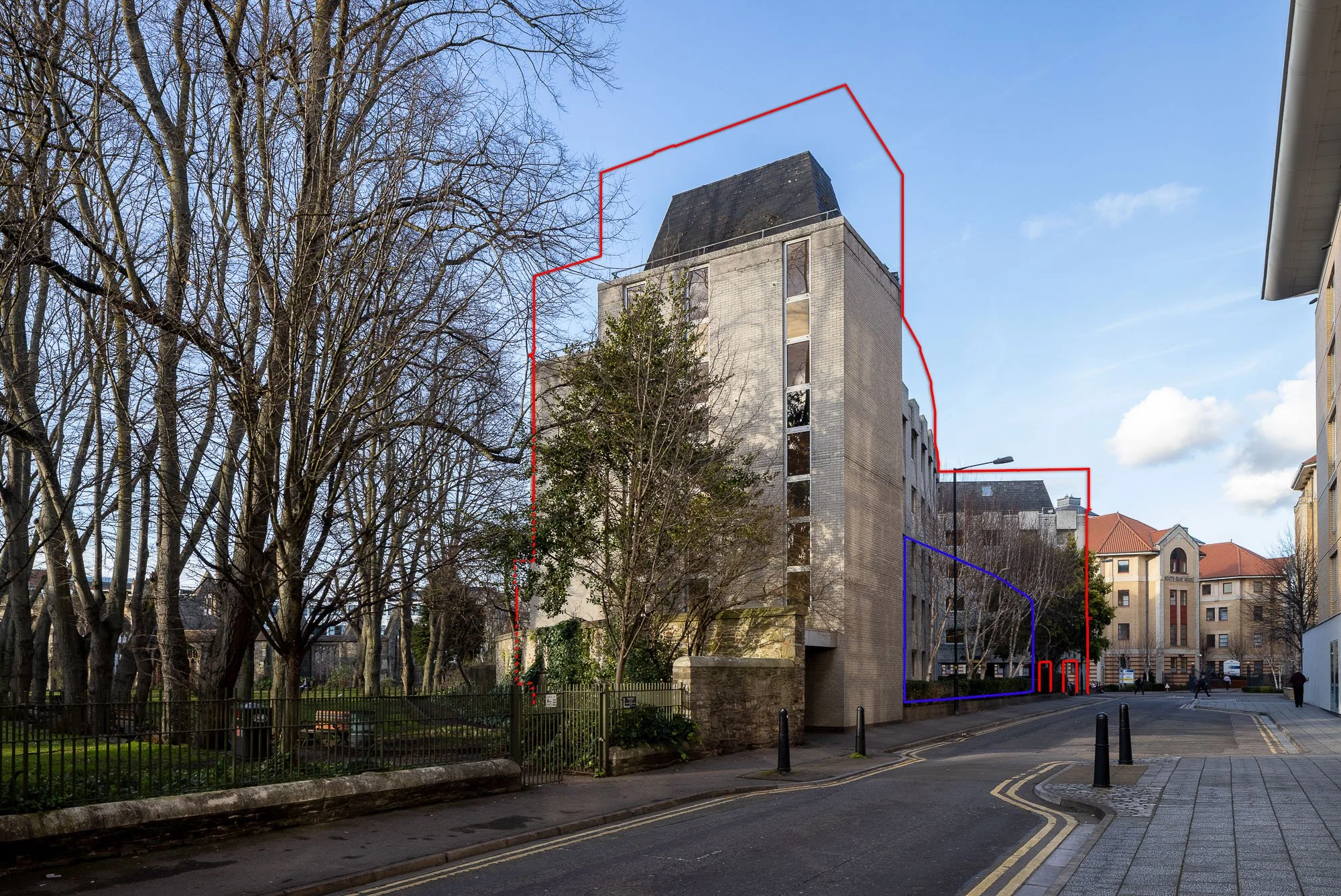
AVRs / Verified views: preconstruct.com
HTVIA: Montagu Evans
Architect: Buckley Grey Yeoman
Planning Stage: Planning granted & scheme completed
Crescent Centre Refurbishment and Roof Extension, Bristol
City-centre office refurbishment and sensitive roof extension within a historically significant urban context requiring careful heritage and townscape assessment to support planning submission.
Our deliverables
8 × AVR1 Wirelines
3 × AVR3 Rendered Views
More info
crescentbristol.co.uk
-
Contributed to successful planning approval for the refurbishment and roof extension of the Crescent Centre by delivering a comprehensive suite of verified views forming a core part of the Heritage, Townscape and Visual Impact Assessment.
Produced 11 Accurate Visual Representations, including AVR3 rendered views and AVR1 wirelines, reproduced directly within the HTVIA and relied upon within visual assessment conclusions.
Supported assessment within a highly sensitive heritage setting, including the Redcliffe Conservation Area and the setting of Temple Church (Grade II listed and Scheduled Monument), where precision and restraint in representing visual change were critical.
Addressed the technical challenge of modelling refurbishment works by ensuring AVRs precisely matched existing building fabric while clearly isolating proposed interventions, including façade rationalisation and new window framing.
Applied high-precision surveying, camera matching and detailed tree masking to accurately represent occlusion within Temple Gardens, and produced 24 mm supporting views aligned with Bristol City Council expectations, strengthening confidence in the visual evidence and supporting conclusions of no harm with beneficial local effects.
Raleigh Road, Bristol
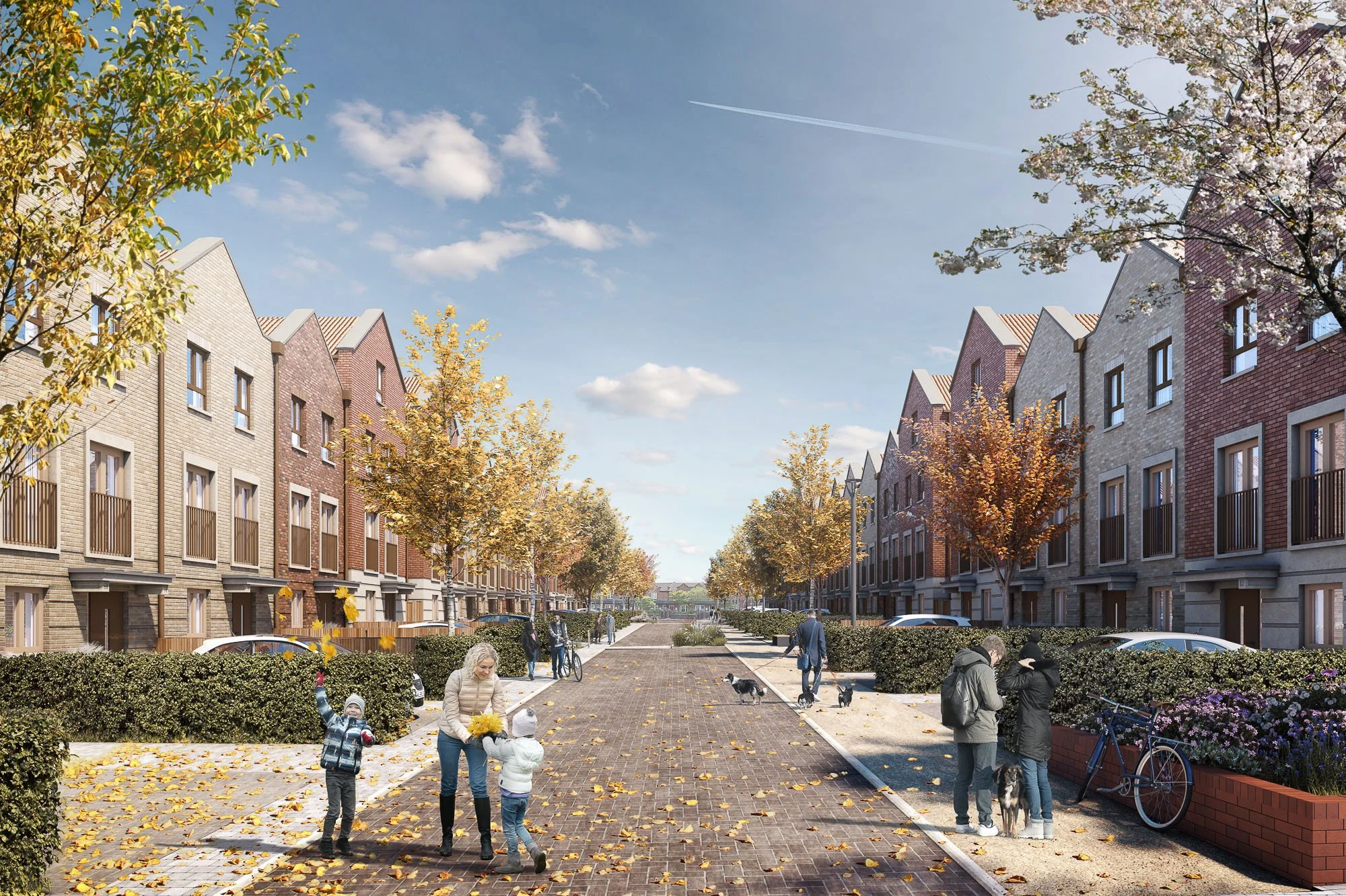
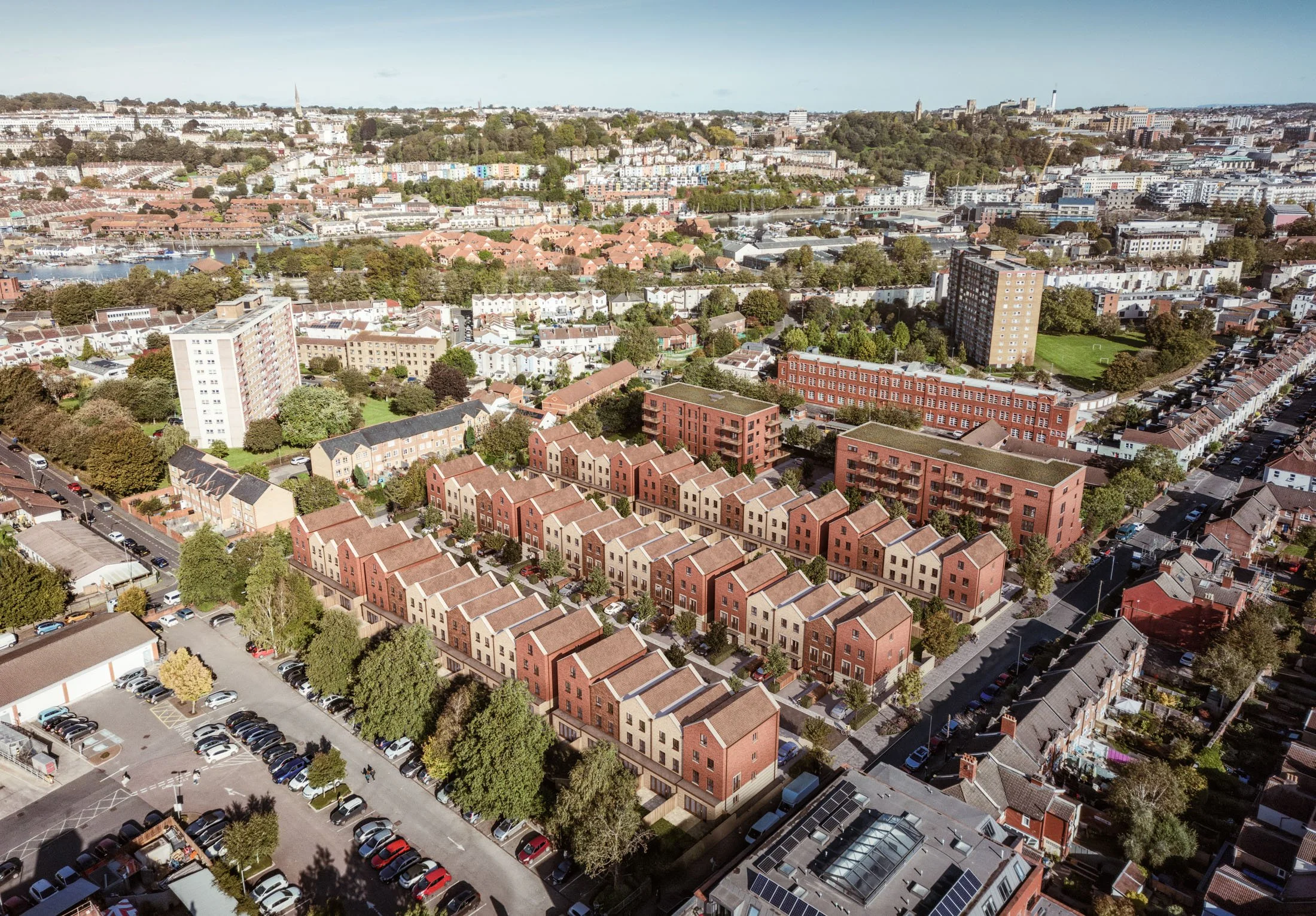
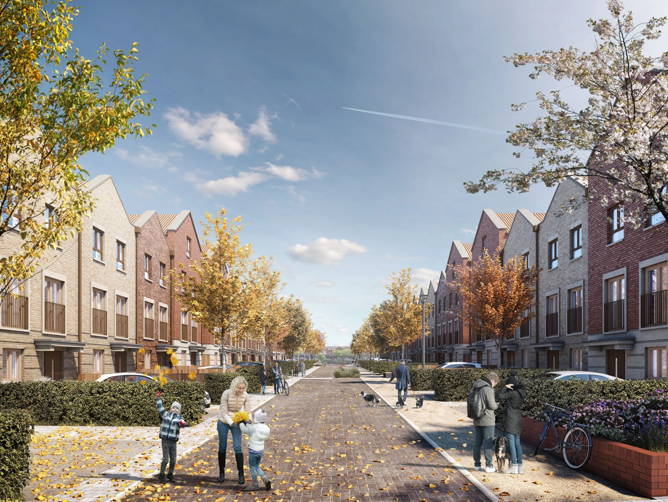
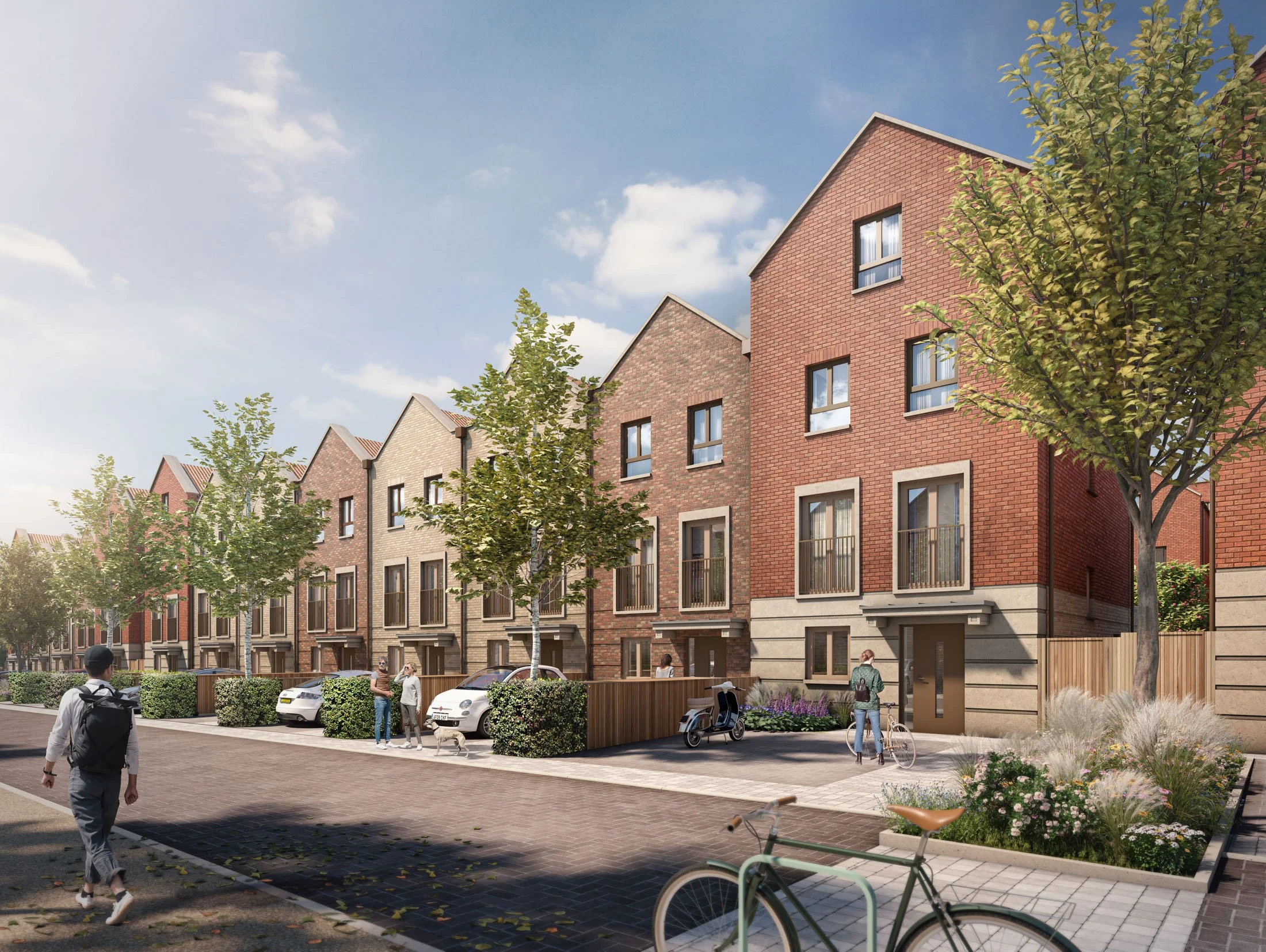
Planning visualisations: preconstruct.com
Developer: The Hill Group
Architect: Alec French Architects
Landscape: TEP
Planning Stage: Planning approved & under construction.
Raleigh Road Residential Redevelopment, Bristol
Residential redevelopment of the former Amerind Grove care home site in Southville, Bristol, replacing a low-density use within the historic Wills Tobacco Factory area.
Planning permission was granted by Bristol City Council in 2025 for 106 new homes, including houses, flats and maisonettes, with approximately 30% affordable housing delivered in partnership with Sovereign Network Group.
The £60 million scheme creates a sustainable residential neighbourhood with landscaped public realm and architecture informed by Southville’s traditional terraced housing character.
Our deliverables
Atmospheric planning CGIs (Non-Verified)
Including Drone aerial photomontage.
-
Delivered high-quality planning CGIs that communicated design intent and supported Bristol City Council’s visual assessment during the application process.
Worked closely with Alec French Architects to accurately capture architectural proportion, material character and spatial relationships, ensuring the visuals reflected the intended quality and detailing of the scheme.
Applied local Bristol knowledge to sensitively represent Southville’s urban grain, scale and neighbourhood character, helping stakeholders understand how the development would sit within its context.
Commissioned and coordinated a drone shoot to produce elevated photomontage views, strengthening understanding of the scheme’s relationship to the wider townscape.
The imagery supported planning arguments around contextual fit and design quality, reducing ambiguity and helping decision-makers interpret the proposals clearly.
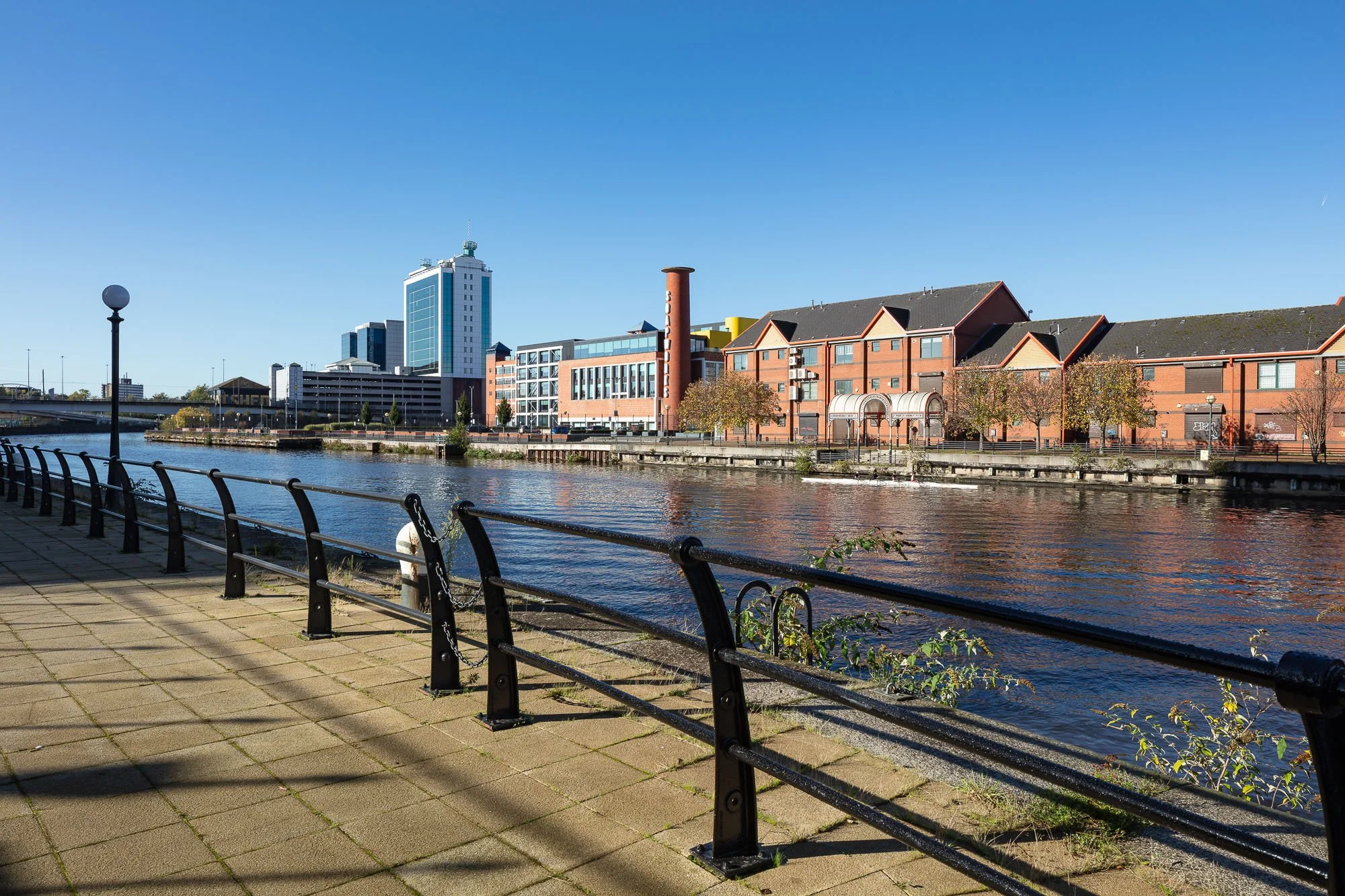
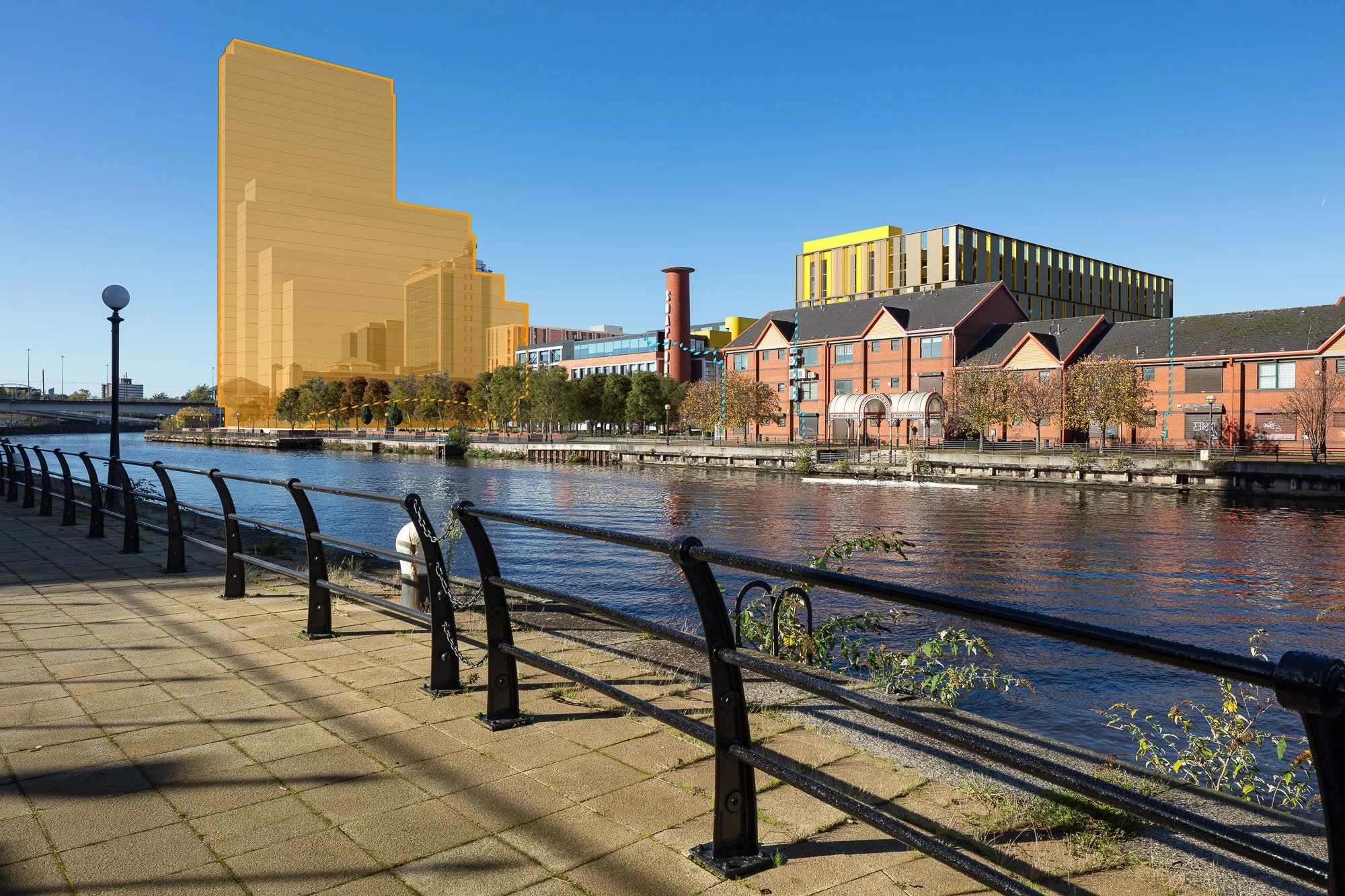
Soapworks, Salford
AVRs / Verified views: preconstruct.com
Developer: Bankfoot APAM
Architect: Chapman Taylor
Landscape: Exterior Architecture
Planning Stage: Granted
Soapworks Regeneration, Salford
Transformation of an 8.5-acre former industrial site into a mixed-use neighbourhood delivering approximately 578 homes, flexible workspace and reuse of the existing factory building.
The £200 million scheme includes a multi-storey transport hub, new public realm, improved pedestrian and cycle connectivity and riverside enhancements. It forms part of the wider regeneration strategy for Salford Quays and the River Irwell corridor.
Hybrid planning permission comprised detailed approval for residential buildings and transport hub infrastructure, alongside outline consent for up to 500 additional homes and associated mixed-use development.
Our deliverables
8 × Hybrid AVRs (AVR1 Wirelines + AVR3 Rendered Views)
-
Supported successful hybrid planning approval by delivering a technically robust AVR suite forming part of the Environmental and Heritage Statement.
Produced eight hybrid AVRs combining AVR3 rendered views with AVR1 wirelines, clearly distinguishing between detailed full elements and outline parameter development across a complex multi-building scheme.
Supported heritage impact assessment within the setting of multiple designated assets, helping consultees and officers understand scale, massing and change.
Delivered 24mm baseline views with high-resolution 50mm equivalent crops aligned with Landscape Institute guidance, and enabled cumulative assessment through precise integration of VuCity views matched to AVR viewpoint locations.
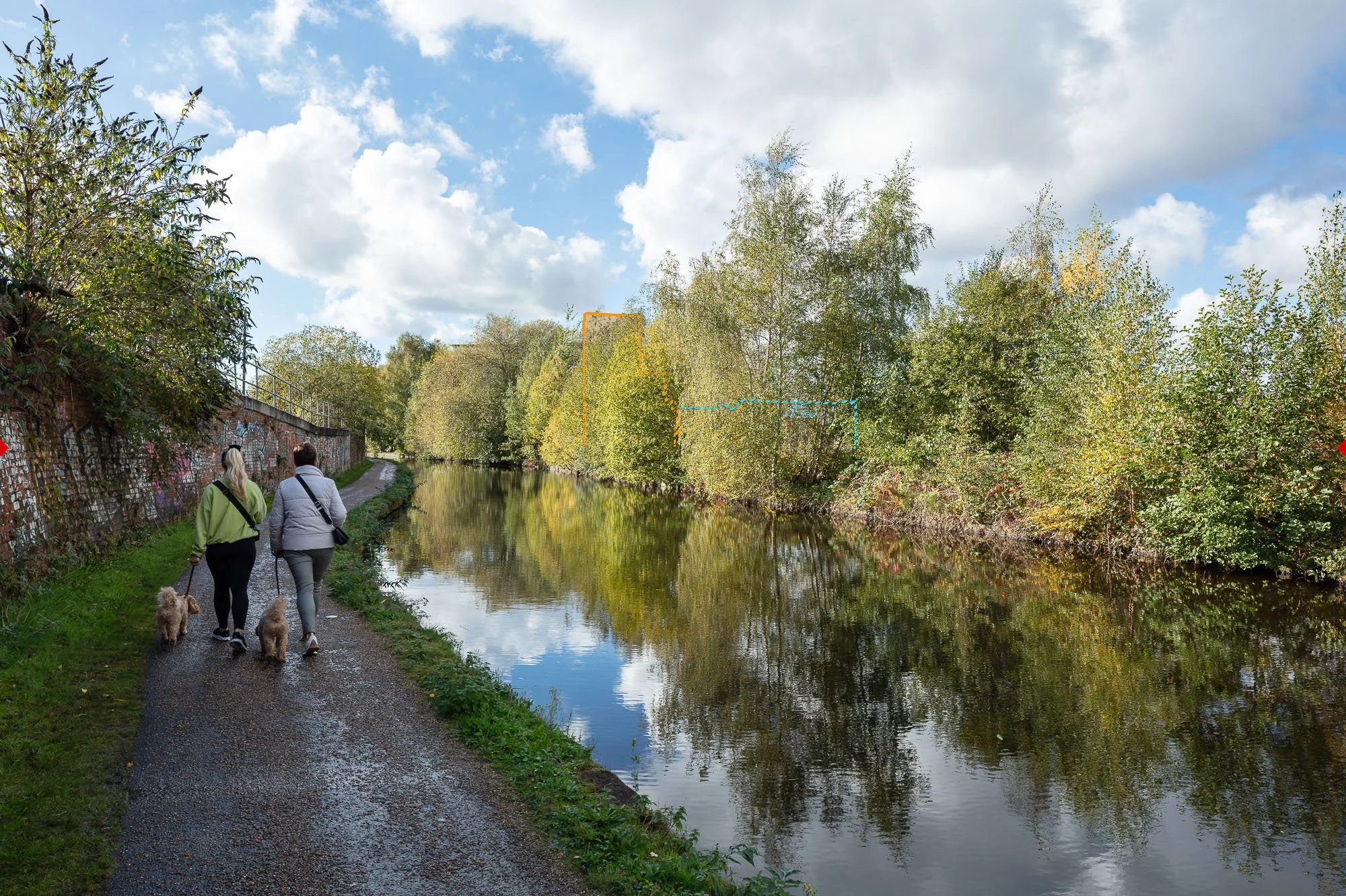
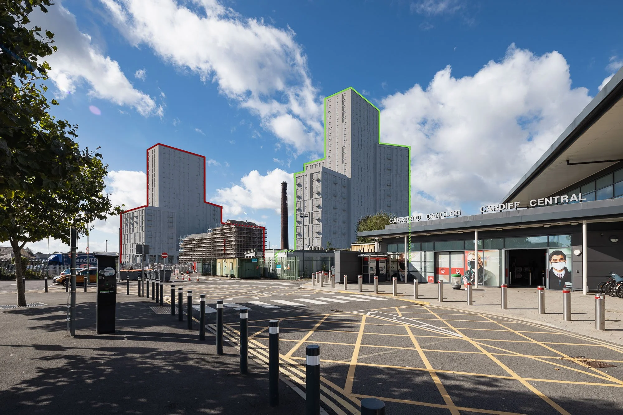
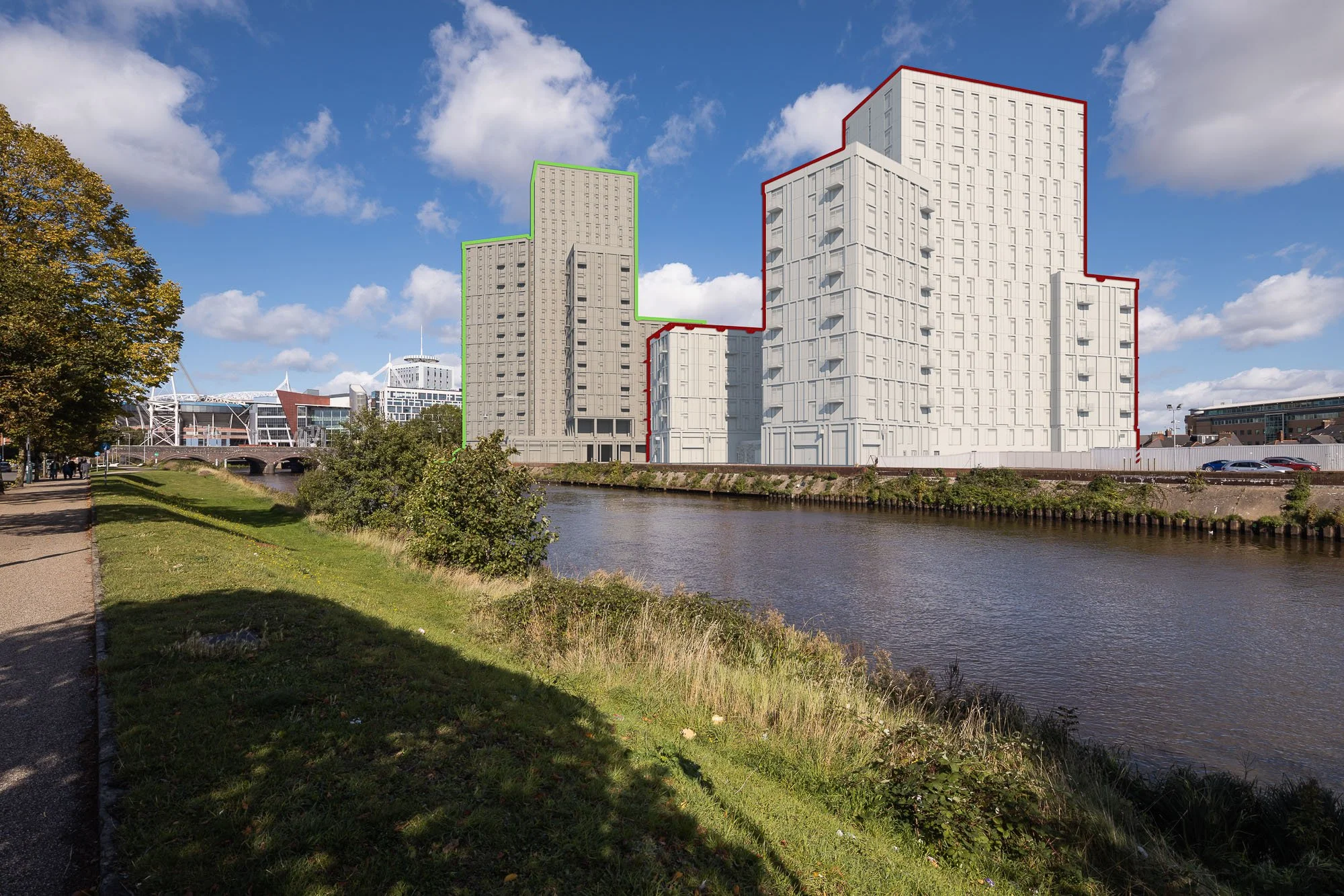
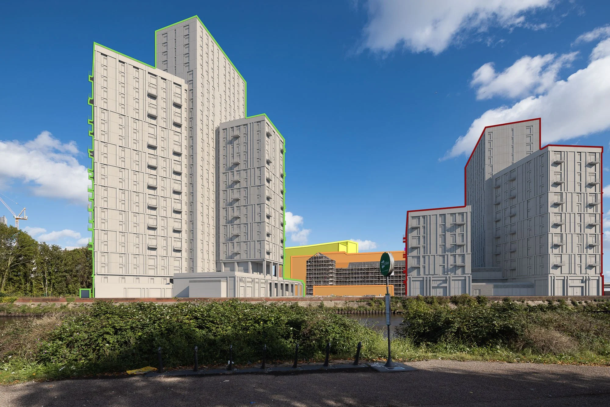
Central Quay, Cardiff
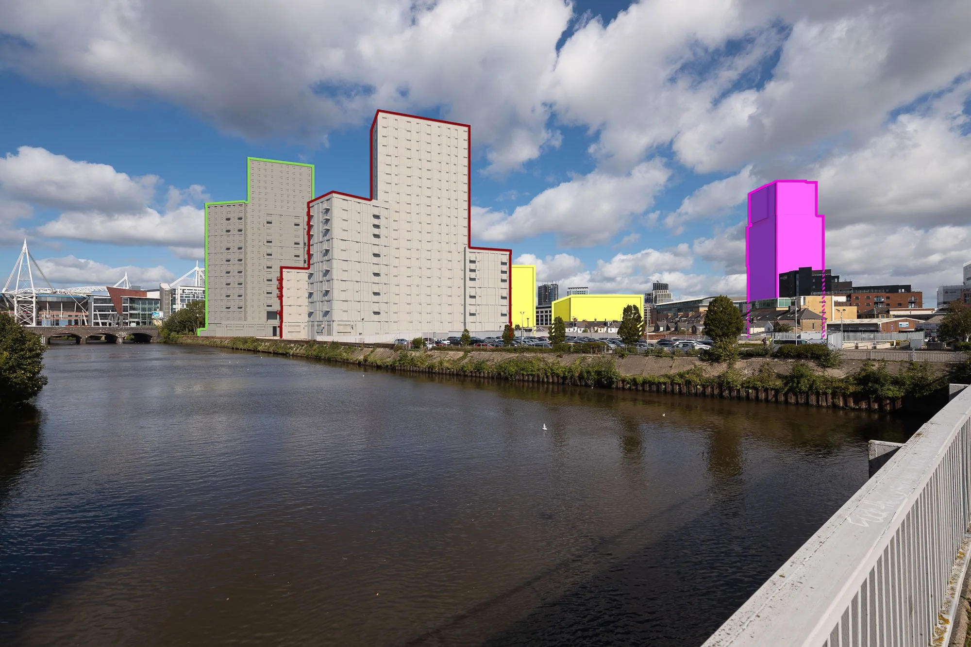
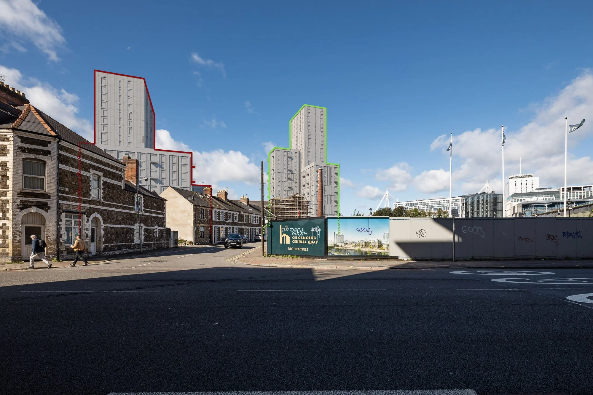
AVRs / Verified views: preconstruct.com
Developer: Rightacres
Planning Consultant: Lichfields
Architect: Rio Architects
Landscape: Churchman Thornhill Finch
Planning Stage: Planning Approved & under construction
Central Quay Phase Two Regeneration, Cardiff
Mixed-use regeneration transforming a prominent Cardiff city-centre site requiring detailed tall-building and skyline impact assessment within a rapidly evolving urban context.
Our deliverables
9 × AVR2 Clay Renders
Including cumulative evaluation.
-
Contributed to a successful planning application by delivering 9 verified views forming a core part of Lichfields’ Townscape and Visual Impact Assessment for a prominent tall-building proposal within Cardiff city centre.
Produced AVR2 clay renders to enable objective assessment of scale, massing, height and form without distraction from materials or lighting, ensuring fundamental planning considerations were clearly communicated.
Addressed the challenges of assessing a tall scheme within Cardiff’s evolving skyline by illustrating how the development would be perceived from key public viewpoints across the city centre and river corridor.
Included cumulative testing alongside consented and emerging schemes to support understanding of combined visual effects and to distinguish individual scheme impact from wider regeneration context.
Supported the Welsh planning and design review process, recognising differences in policy framework and committee scrutiny and ensuring clarity and robustness of visual evidence.
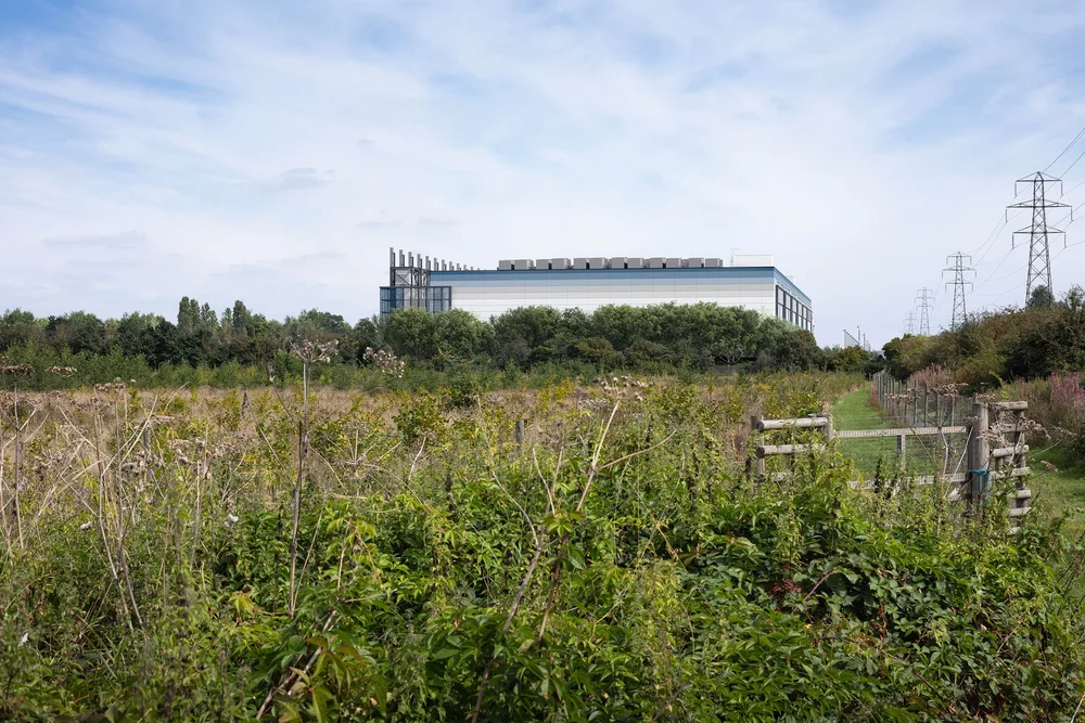

Amazon Data Centre
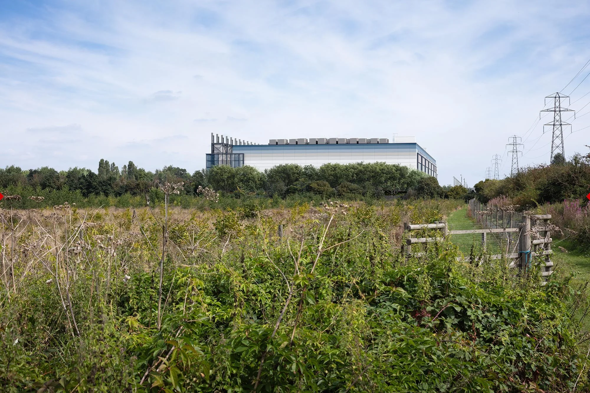
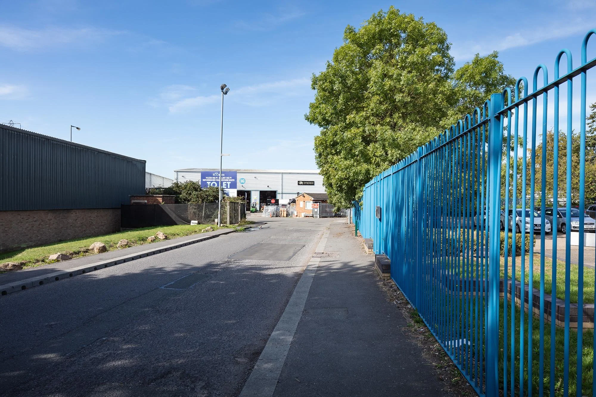
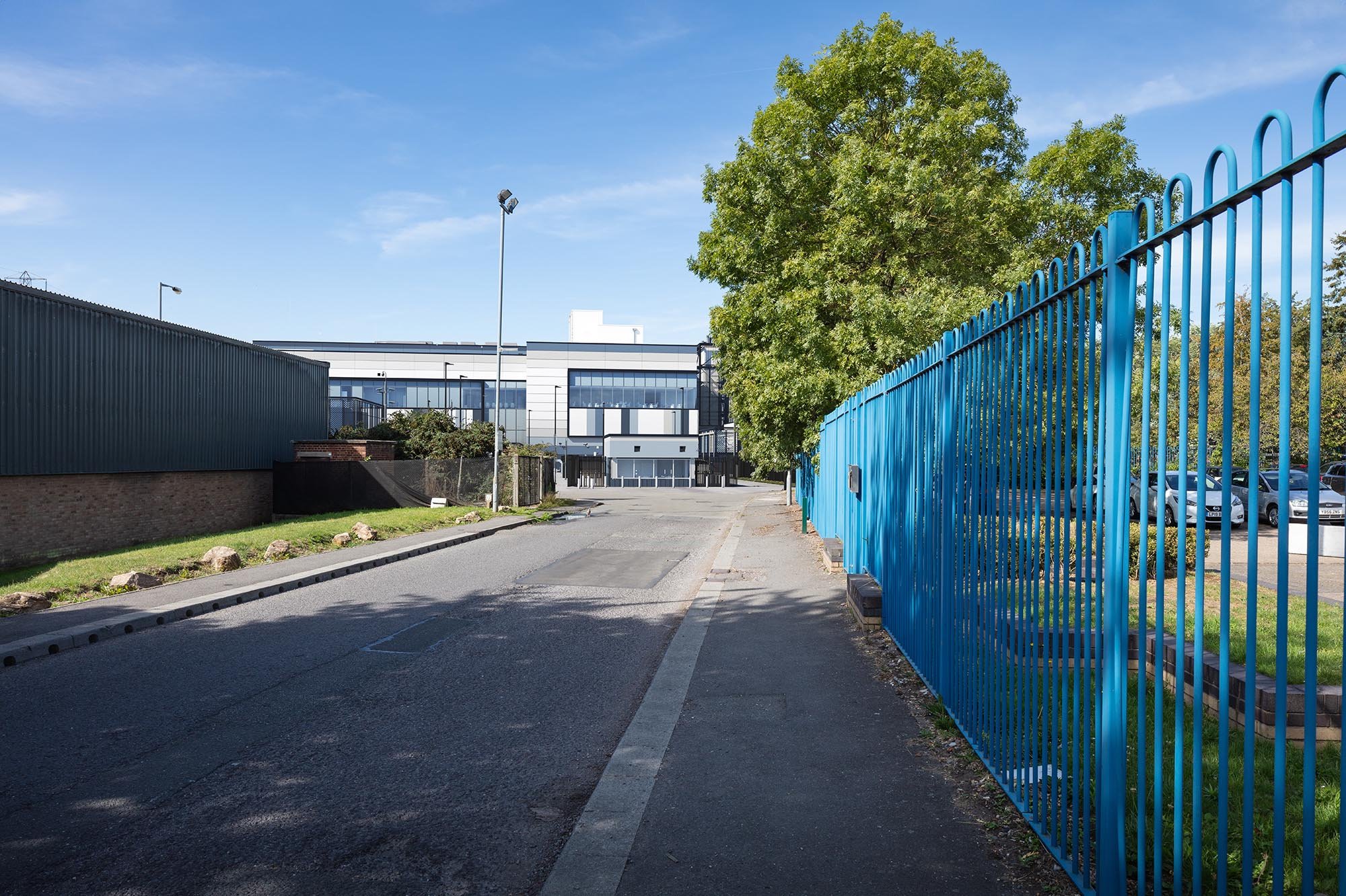
Client: Amazon Data Services / AWS
Project: Ridgeway Distribution Centre Data Centre, Iver, Buckinghamshire
Architect: MCA Architects
Landscape: HED
Planning Consultant & LVIA: Lichfields
Our deliverables
- AVR / Verified Views
- Summer and Winter Versions
- AVR1 Wireline and AVR3 Realistic
We produced a coordinated set of AVR / Verified Views in both Summer and Winter versions, including AVR1 wirelines and AVR3 realistic views, giving the wider planning team robust visual material for review, assessment and submission.
Creating both seasonal versions from the same verified viewpoints allowed the effects of seasonal vegetation change to be understood clearly and consistently. This gave the planning team a more complete picture of year-round visibility and helped support a balanced, evidence-led assessment of the scheme within its landscape context.
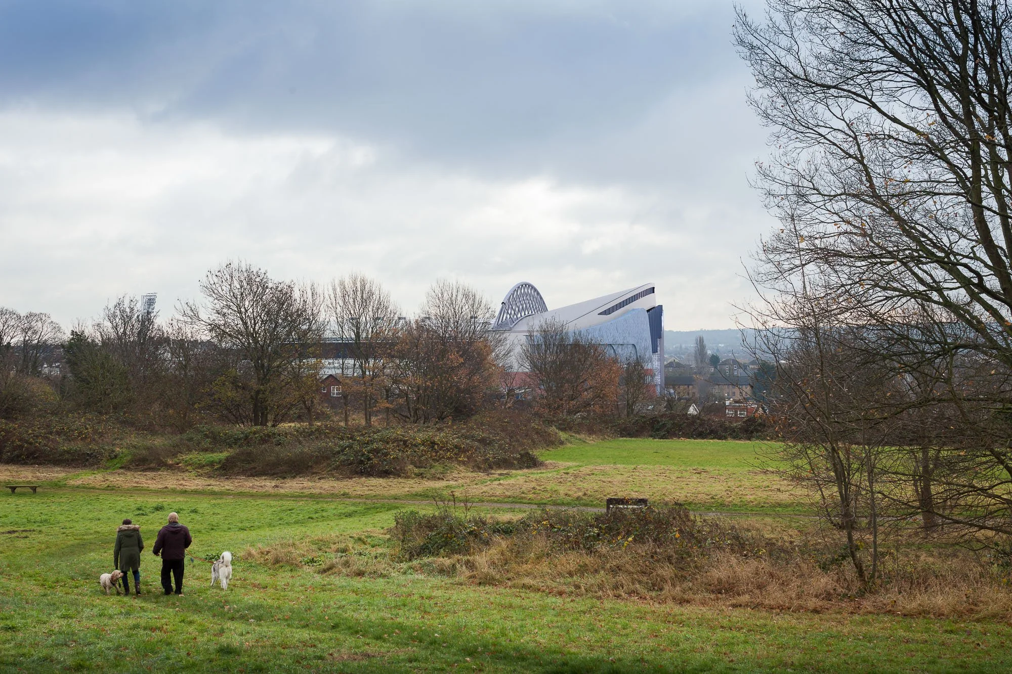
Crystal Palace FC
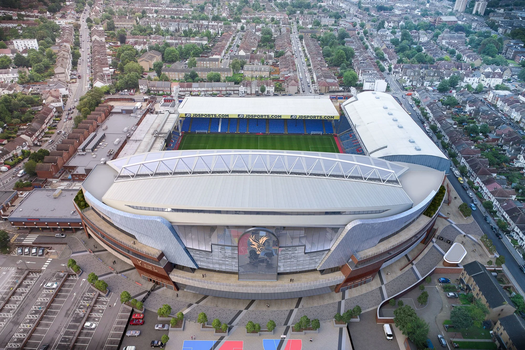
INTERACTIVE 360s!
Planning visualisations: preconstruct.com
Client: Crystal Palace Football Club
Planning Consultant: MRPP Planning Consultancy
Architect: KSS
Planning Stage: Granted
Crystal Palace FC Main Stand Redevelopment, Selhurst Park
Redevelopment of the Main Stand to increase stadium capacity and modernise facilities within a dense urban environment where townscape and neighbour impacts formed a key part of the planning submission.
Our deliverables
CGIs
360 online & VR Experiences
AVR2 Clay Renders
AVR3 Rendered Views
-
In December 2017. Crystal Palace Chairman Steve Parish unveiled ambitious plans to redevelop Selhurst Park, creating a new Crystal Palace for a new era.
Preconstruct's CGIs, animations and VR experiences were the centrepiece of the press launch, showcasing the plans which are expected to cost between £75-£100m.
Our images and online VR experience, spread like wildfire across the web and social media... BBC, Sky Sports, NBC Sports, ITV, Guardian, Telegraph, Daily Mail, The Mirror, Evening Standard.
Stadium developments attract high levels of stakeholder scrutiny and require absolute clarity in how scale and visual impact are communicated.
AVR2 outputs enabled objective evaluation of scale and skyline presence, while AVR3 views communicated material presence and stadium character. The addition of CGI and immersive 360 VR content supported wider stakeholder engagement, helping audiences understand spatial relationships and match-day environment more intuitively. The combined approach strengthened planning communication and supported evidence-based assessment of a complex, high-profile redevelopment.
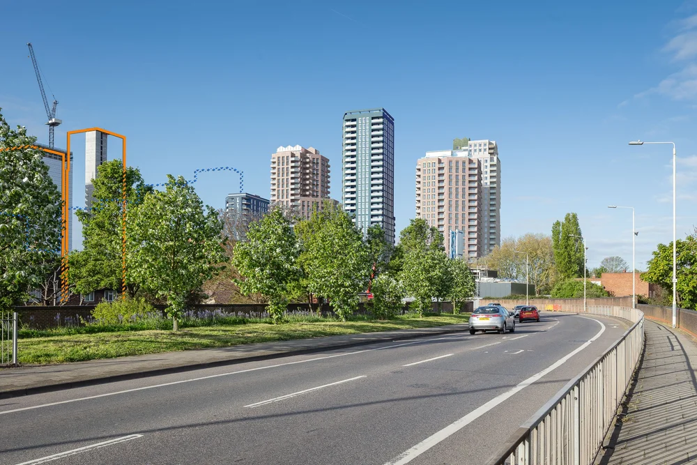
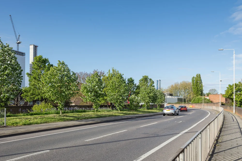
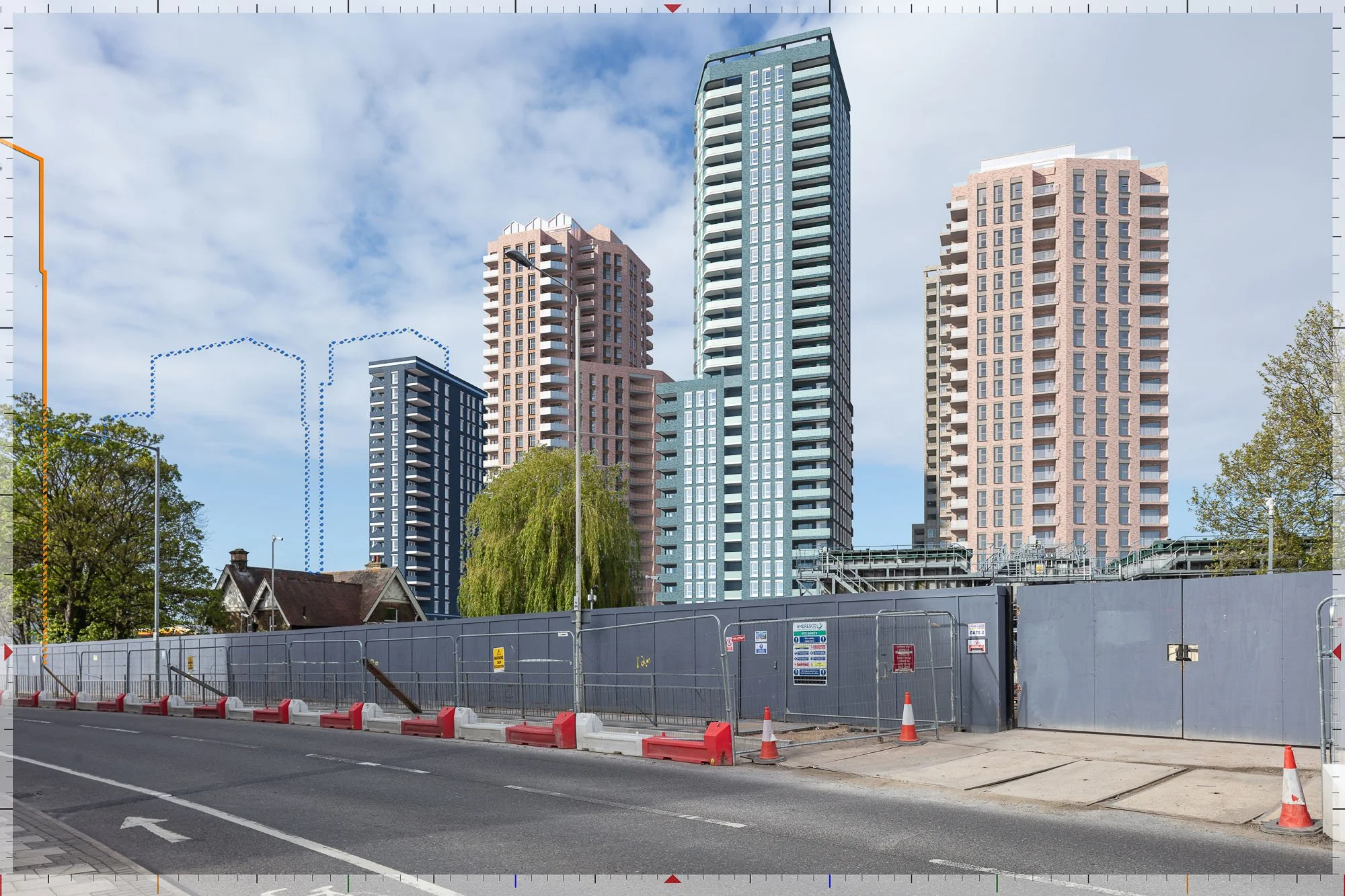
Hertford Road, Barking
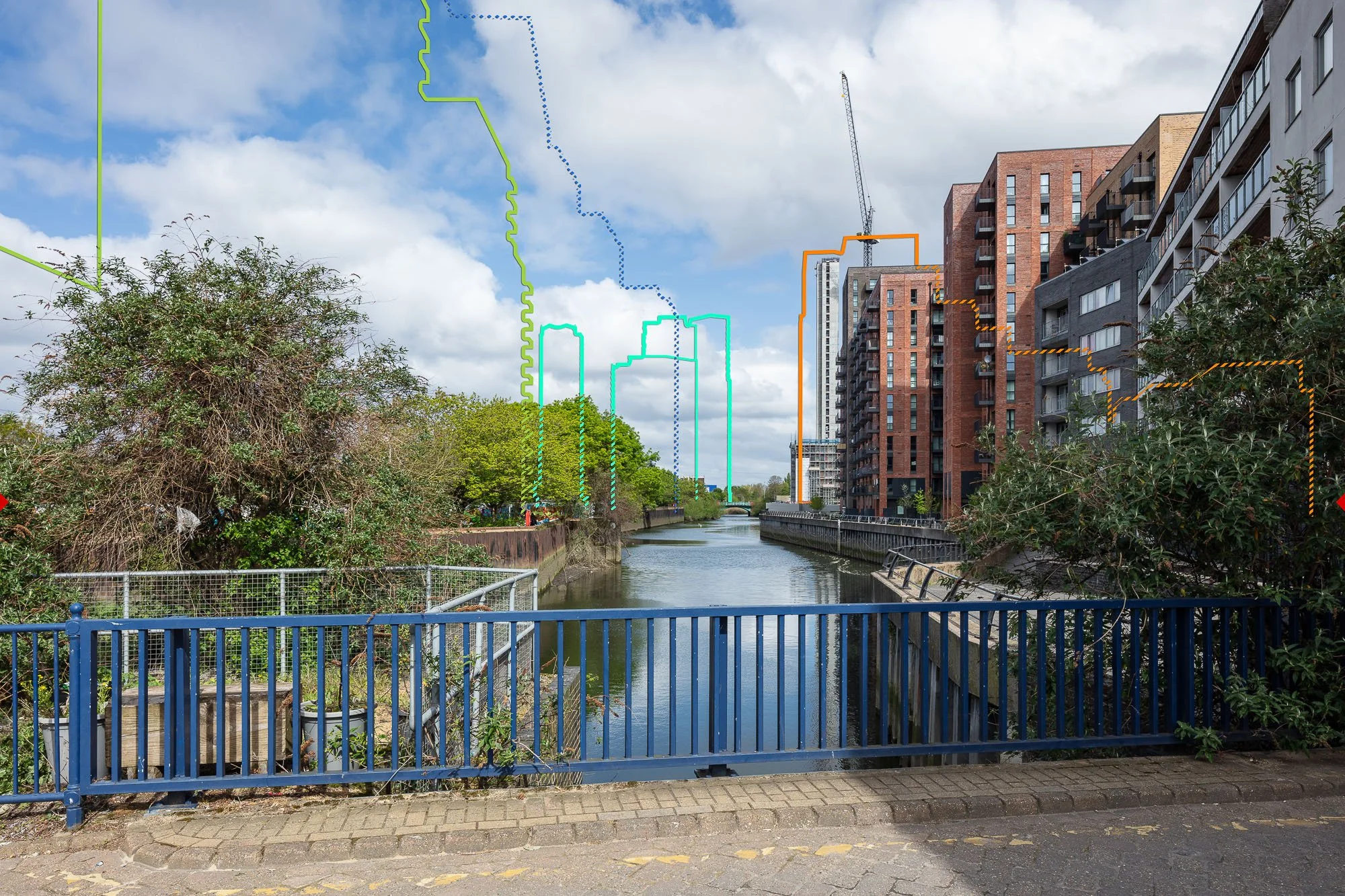
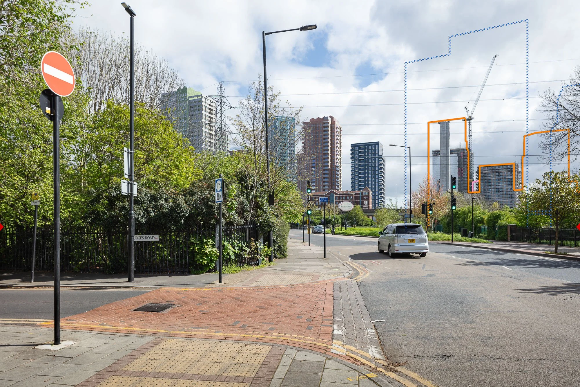
AVRs / Verified views: preconstruct.com
Planning Consultant & TVIA: Iceni
Architect: Makower Architects
Landscape: Outerspace
Planning Stage: Approved subject to legals
Hertford Road Residential Regeneration, Barking
Redevelopment comprising six buildings ranging from 18–31 storeys delivering approximately 850 homes alongside flexible commercial and community floorspace, supported by public realm improvements and riverside path enhancements.
The scheme forms part of Barking’s wider regeneration strategy, improving housing delivery, connectivity and public realm quality within a rapidly transforming riverside context.
Our deliverables
8 × AVR1 Wirelines (including cumulative schemes)
7 × AVR3 Rendered Views (including cumulative schemes)
-
Strengthened Iceni’s EIA evidence base at committee stage for this tall, sensitive riverside development. Delivered a substantial verified package enabling both analytical assessment of height and massing and accessible public interpretation of appearance and materiality.
Supported cumulative assessment alongside surrounding consented and emerging development, helping decision-makers clearly understand skyline presence, cluster relationships and change along key riverside and pedestrian routes, reducing ambiguity during determination.
Learn more…
Planning visualisation
View our…
Planning gallery
Preconstruct brings spaces, places and ideas to life.
We’re a creative studio specialising in the built environment. We craft images, animations and interactive experiences that inform, excite, and inspire.
Our team is known for our technical excellence and friendly approach.
More about us.